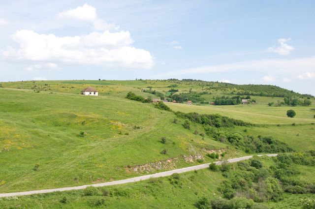
Karajukića Bunari sector, about 25–30 km from Sjenica; Tourist Organization of Sjenica, Kralja Tvrtka I 11, 36310 Sjenica

Pešter works best as a slow highland stay rather than a stop between larger towns. The main base is Sjenica, with Tutin more useful for the southern side, and the reserve makes most sense with at least two overnights. What draws people here is not a tight cluster of monuments but treeless pasture, changing weather, inhabited katuni in summer, gravel roads, and a strong sense of distance.
Pešter Plateau lies in southwest Serbia between the Lim and Ibar rivers, across the Sjenica–Tutin–Novi Pazar triangle, with most of it in Sjenica municipality and the southern part in Tutin. Its area is measured in hundreds of square kilometres. Sources place the elevation between 900 and 1,250 metres, with about 1,150 metres used as the average, while the highest point reaches 1,492 metres. The name keeps the trace of what lies below ground: pešter is an old word for cave, and the limestone surface is cut by sinkholes, swallow holes and underground watercourses; Borovštica is the largest river on the plateau itself. The overall mood is wide, spare and exposed.
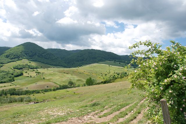
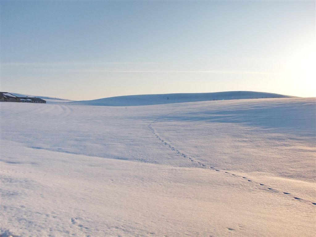
What makes Pešter distinct is the contrast between its two seasonal faces. In summer it opens into green pasture without fences or woodland, with katuni occupied and livestock out on herb-rich grass that can be cut up to three times a year; by that abundance of hay, local tradition explains the name of Sjenica. Because of the height and the open horizon, the plateau is sometimes called Serbian Tibet. In winter the same ground turns into a snowfield with long cold spells and short cool summers on either side of it. The average annual temperature is about 6°C, and snow stays for around 60 days a year. On 26 January 2006, Serbia’s lowest recorded temperature, −39°C, was measured in Karajukića Bunari, which fixed the nickname Serbian Siberia.
The cold has a clear physical reason. On Pešter, temperature inversion pulls cold air down from the surrounding mountains and holds it in the field, especially in the lower ground around the lake near Karajukića Bunari, while the nearby hills can be several degrees warmer. That matters for overnighting, since higher ground is more favourable than the basin floor, and even summer days at 1,150 metres can end with a sharp night-time drop. The plateau was once covered in pine forest; its decay created a broad peatland that is described as the largest peat deposit in the Balkans, and sources say that 95 percent of the potting soil used in Serbia comes from Pešter. The reserve around Peštersko jezero adds wet meadows, clean watering streams and habitat for more than 170 bird species, including the last Serbian habitat of the corn crake, which is why Pešter carries both domestic and international protection.
Built sights around the plateau explain its Ottoman and monastic layers.
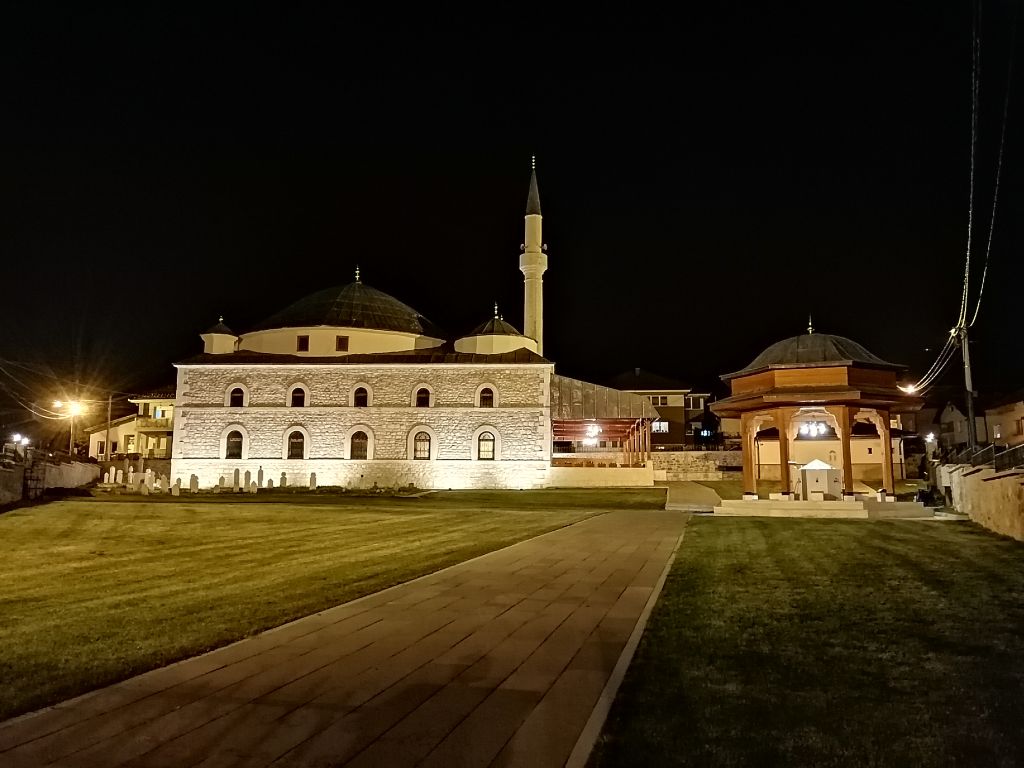
Sultan-Valide Mosque, Sjenica
An endowment of the mother of Sultan Abdul Hamid II from the 19th century and the only imperial mosque on the territory of Serbia because it was built by a sultana. It was raised without pillars and without foundations, with a 15-metre wooden dome that was originally covered with lead plates. Local tradition says that goods and ducats recovered from robbed caravans were given for its construction.
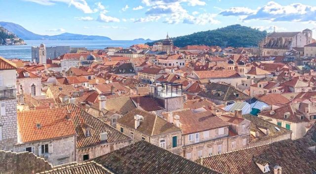
Askerli Mosque, Ugao
The oldest preserved mosque in the municipality of Sjenica, built in 1704 as part of a Turkish military fortification from cut stone. It was damaged and burned several times, last restored in 1976; the exterior changed, but the interior remained authentic and entirely wooden. Ugao itself sits on the narrowing of the Pešter field and takes its name from an ublo, a pit with drinkable water.
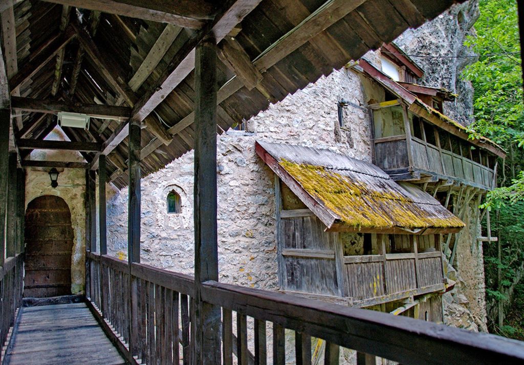
Crna Reka Monastery, Ribariće
Set into the rock above a gorge in the village of Ribariće near Tutin. The monastery is named after the Black River beside it, a sinking river that disappears about a kilometre and a half upstream and appears again after two kilometres.
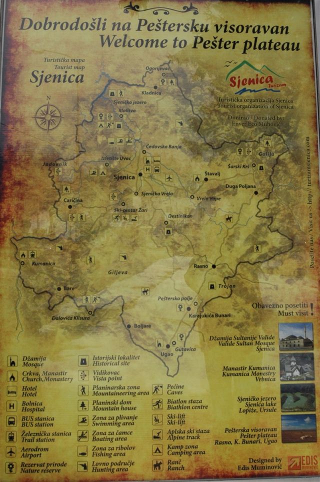
Sjenica is the main gateway. It stands on the Raška–Novi Pazar–Sjenica–Nova Varoš cross-route that links the Ibar and Zlatibor main roads, so the plateau can be reached from either of the main approaches into southern Serbia. Approximate distances from Sjenica are 60 km to Novi Pazar, 50 km to Tutin, 60 km to Ivanjica, 130 km to Kraljevo, 290 km to Beograd and 370 km to Novi Sad; Karajukića Bunari, the central point of the reserve, is about 25 to 30 km away. The source material does not publish local public-transport line numbers, and the decisive practical issue is road surface: key points inside the reserve sit on gravel roads. That is why Pešter is not treated as a quick day trip. Two nights is the realistic minimum, while three days allows both the Sjenica and Tutin sides. The same route also explains why campers and motorcyclists use Pešter as a sea-bound detour toward Montenegro: long empty roads, horizon lines of seven mountains, and stretches with almost no settlements or traffic. Formal parking areas and taxi fares are not published in the source material.
June to September is the only period when the plateau works at full capacity: gravel sections are dry, katuni are occupied and pasture is in use. July and August are the safest months for gravel roads. May and October bring emptier roads and useful light for photography, but with a greater risk of rain and softened surfaces. Winter travel inside the reserve needs an off-road vehicle and a local driver, because those sections are not part of priority winter maintenance.
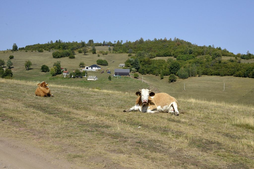
Pešter does not work like a compact attraction zone. There is no tourist centre inside the reserve, and there is no classic cluster of lodging inside the protected area itself. Its value lies in space, silence and proximity to the sky rather than in resort infrastructure. The everyday scene is made of pasture, stock watering places, changing wind and long sightlines, and practical decisions depend on weather and road surface. Coffee or cheese beside a katun can become part of the day because hospitality here belongs to ordinary life, not to a staged programme. The plateau is also a starting ground for walking up Golija, Zlatar, Javor and Jadovnik.
The plateau also stands on a historic crossroads. Archaeology points to human presence from prehistory, and nearby medieval fortresses, monasteries and trade routes show why the area mattered in the Middle Ages. Later, the road through Novi Pazar carried trade from Istanbul toward Bosnia, and the meeting of eastern and western influences left traces in local architecture, customs and cooking. A longer stay commonly stretches toward Uvac Canyon, the monuments of Stari Ras and Sopoćani, or Crna Reka Monastery, with Novi Pazar as the larger urban stop on that wider circuit. Through all of those layers, the constant has been livestock, seasonal movement and dairy production.
Sources cross-checked for this guide:
Last checked: 4 August 2026. Fact-checked by the editorial team led by Patrick against the official sources above, and reviewed before publishing.
Article text follows the pasted source text for the body. Contact details and office hours reflect the published tourism contacts included in that material.
Sjenica is the basic choice. The town lies at 1,000 to 1,030 metres in the Sjenica basin on the right side of the Uvac. It has the widest lodging supply, shops and fuel, and all plateau points are within about an hour. From here, Sjenica Lake and the Uvac meanders are about 6 km away, Molitva viewpoint about 10 km, Žari ski centre 7 km, Jadovnik 12 km, and the Special Nature Reserve Peštersko polje about 25 km. The offer includes hotels in town, nearby ethno-settlements with log cabins and categorised rural tourist households.
Tutin is the better base when the southern part of the plateau is the priority, especially Đerekare, Crna Reka, Godovska cave and the Ibar gorge. The Gazivode lake reaches Ribariće, and motels are found both in Ribariće and in Tutin.
Karajukića Bunari is the usual central map point for the reserve, with Sjenica as the main approach town.
These named stops show Pešter through space, weather, pasture life and local tradition rather than through formal sightseeing infrastructure.
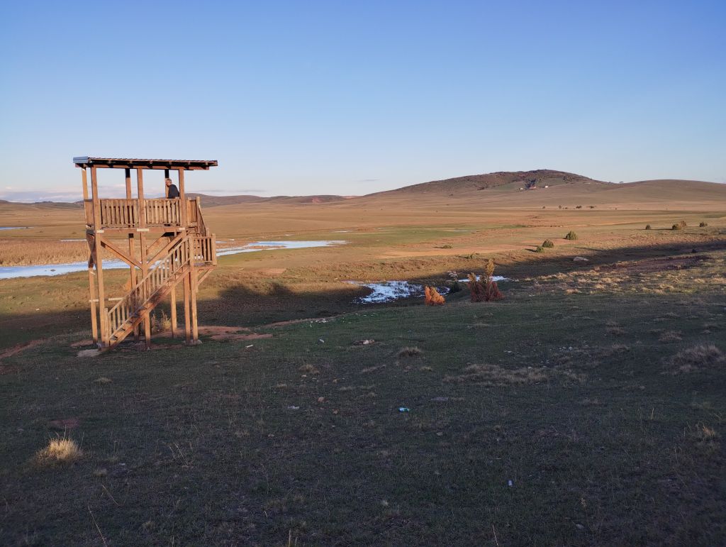
Peštersko jezero and Karajukića Bunari
The central wetland area where Pešter’s marshes, pasture and cold-basin climate are easiest to read.
More than 170 bird species are recorded around the lake and about 90 are on the global red list. Organized observation is centred on Karajukića Bunari; the gravel road from the village to the lake is usually passable by a standard car, two hides are reached only on foot, and the west embankment is the main open observation point.
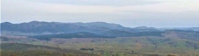
Trojan
A high point above the field and the landscape feature most tied to local dragon stories.
A walking route in the reserve climbs to Trojan before dropping toward Đurđevica spring. The height of Trojan varies across sources from 1,340 to 1,430 metres, while another plateau source puts the highest point of the wider plateau at 1,492 metres.
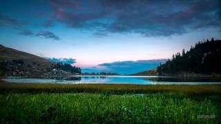
Đurđevica Spring
The spring that local tradition treats as the one place on the plateau that never dries or freezes.
Legend says St George struck stone here before killing the three-headed dragon once said to live in the lake below Trojan. The spring and the marked stone with footprint and horse-hoof traces remain part of Pešter storytelling.
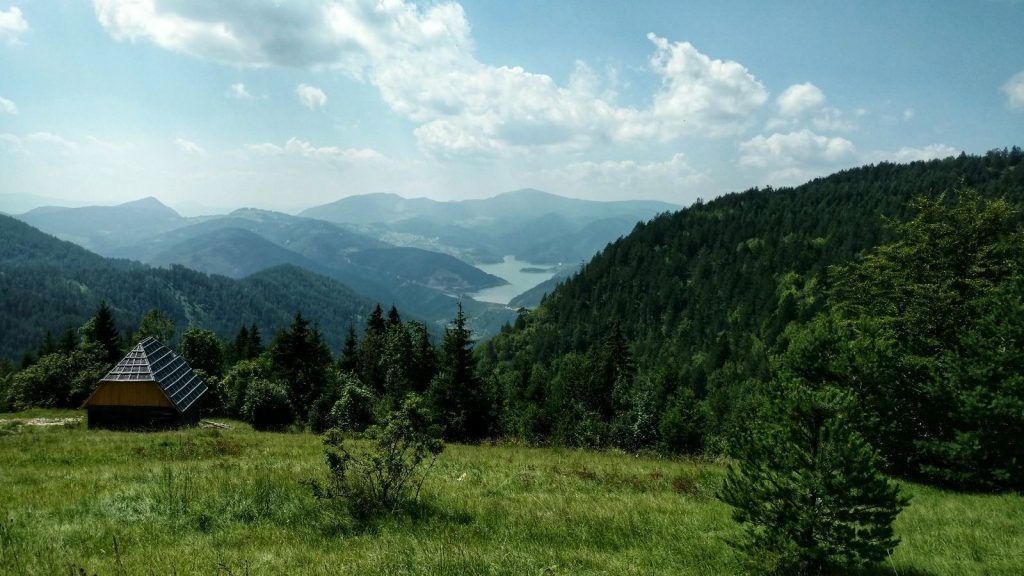
Pešter katuni
Seasonal cattlemen’s huts built from mud, wood and stone, still used in summer.
Katuni are not preserved as museum pieces but as working shelters in the pastoral cycle. Summer is the time when the plateau’s economy is most visible, with grazing livestock, milk production and cheese making tied to herb-rich pasture.
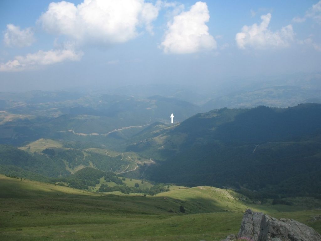
Love Tree at Đerekare
A willow on the Tutin side known locally as the Love Tree.
Near Đerekare, local tradition says lightning struck the tree three times and it kept growing. Engagements are still held beside it as a sign of lasting attachment.
Karajukića Bunari sector, about 25–30 km from Sjenica; Tourist Organization of Sjenica, Kralja Tvrtka I 11, 36310 Sjenica
Sjenica
Open karst pasture, peatland and harsh seasonal contrast
n/a
June to September; July and August are safest for gravel roads
No formal reservation for the plateau; winter access needs a local driver
Tourist Organization of Sjenica: Kralja Tvrtka I 11, 36310 Sjenica; phone +381 20 744 843; emails turistickasjenica@gmail.com and info@tosjenica.rs; Monday to Friday 07:00–15:00; weekends closed. Additional numbers: +381 64 858 13 08, +381 64 826 84 41 for the guide service (tosjenicavodickasluzba@gmail.com), and +381 64 826 84 45. Website: tosjenica.rs.
Guardian service of the Special Nature Reserve Peštersko polje: +381 62 8647 812 and +381 64 8268 448. Center for Tourism, Culture, Youth and Sport Tutin: +381 20 811 417, turizam@tutin.rs.
Cold air settles in the field rather than on the surrounding rises. For camping or overnight positioning, higher ground above the basin is more favourable than the lowest ground near the lake. In winter, sections inside the reserve are not part of priority road maintenance, so the source material treats an off-road vehicle and a local driver as necessary.
Pešter is one of the Serbian areas with the highest number of products protected by geographical indication. Protected names include Sjenica sheep cheese, Sjenica lamb, Sjenica cow cheese and Sjenica sudžuk. Alongside those come mantije, baklava, buckwheat dishes and jardum, a thick reduction of sheep’s milk that is hard to find outside the plateau.
Local storytelling remains attached to the plateau. One story places a three-headed dragon in the old lake, killed by St George below Trojan, and connects nearby place names to that event, including Krnja jela, where the dragon’s tail was said to have broken the fir trees. On the Tutin side, near Đerekare, a willow known as the Love Tree is said to have survived three lightning strikes; engagements are still held beside it so that affection will last.
Not really. The source material treats two nights as the realistic minimum because the central points lie well beyond Sjenica and the decisive factor is the gravel road network inside the reserve. Three days is the better rhythm if both the Sjenica and Tutin sides are included.
June to September is the practical main season. July and August are the safest for dry gravel roads, while May and October can work for empty roads and softer light but bring a higher risk of rain and muddy surfaces.
The name comes from its cold basin climate. Serbia’s lowest recorded temperature, −39°C, was measured in Karajukića Bunari on 26 January 2006, and the plateau’s temperature inversion means cold air settles in the field rather than on the surrounding rises.
Sjenica is the main base because it has the broadest lodging, shops and fuel, and most plateau points are within about an hour. Tutin is the better base when the southern side, Đerekare, Crna Reka, Godovska cave and the Ibar gorge are the priority.
Not necessarily in the drier season. The source says the gravel approach from Karajukića Bunari to the lake is usually passable by a standard car, but winter travel inside the reserve calls for an off-road vehicle and a local driver.
The best-known protected products are Sjenica sheep cheese, Sjenica lamb, Sjenica cow cheese and Sjenica sudžuk. Mantije, baklava, buckwheat dishes and jardum also belong to the local food pattern.
Serbian Travel can help shape a practical itinerary around Sjenica, Tutin, Novi Pazar and the wider southwest Serbia circuit.
Stay connected in Serbia