Eastern Serbia, near the Bulgarian border
Stara Planina — Old Mountain in Serbian — is the range that gave the Balkan Peninsula its name. It runs along the border with Bulgaria in southeastern Serbia and reaches its highest point at Midžor, which sits almost exactly on the border. The mountain spans altitudes between 600 and 1900 m, and holds more waterfalls than any other part of Serbia, along with numerous caves that remain largely unexplored.
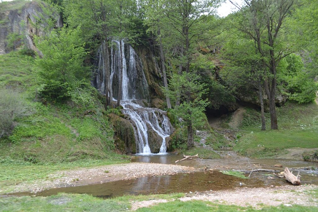
Key landscape features include the Zavoj Lake, 17 km long and 70 m deep, formed after a 1963 landslide created a natural dam that the army subsequently reinforced with a hydroelectric installation; the Tupavica waterfall, 15 m high, 4 km from Dojkinci; and the Piljski Donji waterfall, 64 m high — the second highest in Serbia — known only to locals until 2002. The stone village of Gostuša won the EU Heritage / Europa Nostra prize in 2016 for its restoration approach.
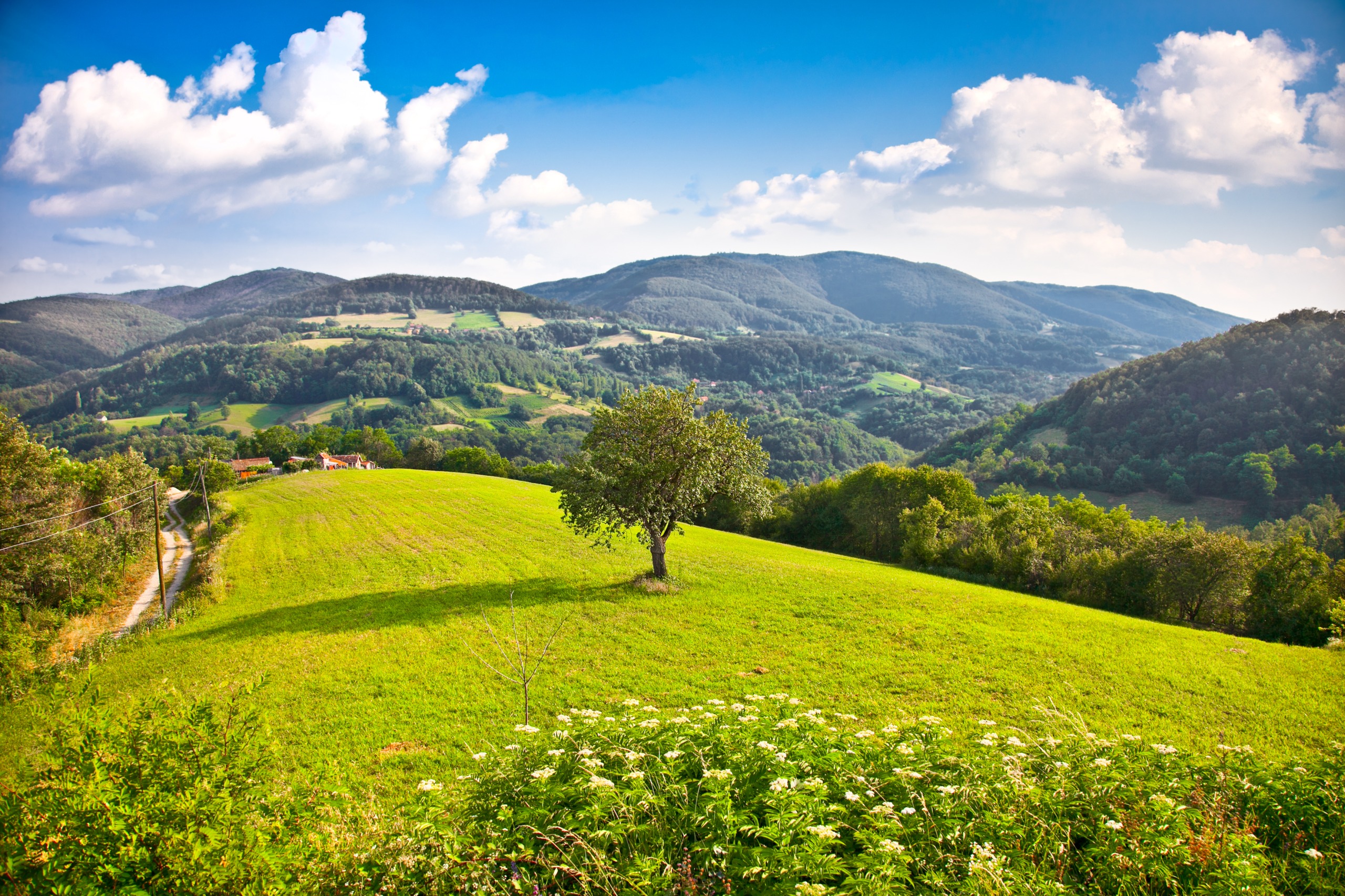
Stara Planina is the source of the name 'Balkan' — the range that gives the peninsula its identity. In Serbia it forms a natural barrier on the eastern border, with terrain that shifts quickly between forested lower slopes, open highland meadows, rocky ridgelines, and high karst features. Drawing on Matthias Pasler's Serbia Travel Pocketbook: the mountain villages are mostly inhabited by a few hundred older residents; during the day these feel like ghost settlements whose houses and rhythms have not changed in a hundred years.
Access is primarily by car from Pirot or Knjaževac. The tourist office in Pirot coordinates outdoor activities information; the official website www.jpstaraplanina.rs provides hiking maps, ski conditions, cycling, fishing and hunting permits, and background on the protected natural landscape.
The highest summit, Midžor, can be hiked with maps from www.jpstaraplanina.rs. The surrounding landscape between 600 and 1900 m altitude contains most of Serbia's waterfalls in a single mountain range. The Tupavica waterfall (15 m) is reached by a 4-km walk from Dojkinci village; the Piljski Donji (64 m) requires a 4.5-km walk from Topli Do toward Dojkinci and was unknown outside the local area until 2002.
The Zavoj Lake (Zavojsko jezero, 612 m altitude) is 17 km long and averages 300 m wide, with a depth of 70 m. It originated in February 1963 when heavy snowmelt triggered a landslide that formed a natural rubble dam. As the backed-up water became a growing hazard, the Yugoslav army built a concrete dam and hydroelectric station. The village of Zavoj was flooded in the process and gives the lake its name. The best viewpoint is Kozji Kamen: drive 12 km on the road toward Rsovci, then walk 3–4 km from the signpost.
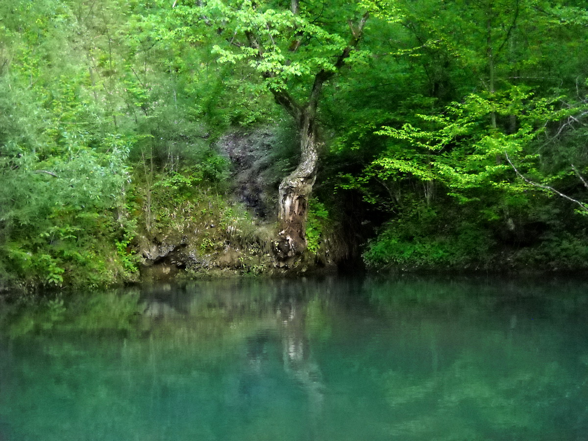
The Jelovica spring near Vrelo village emerges from a limestone formation with water from unexplored underground channels that a German diving team reached to 48 m depth in October 2012 without finding the other end. The spring runs dry around the same week each August without a known explanation. At 1000 m altitude, Stara Planina also produces the nationally known Visok potato (Visočki krompir), grown in certified organic conditions at altitude.
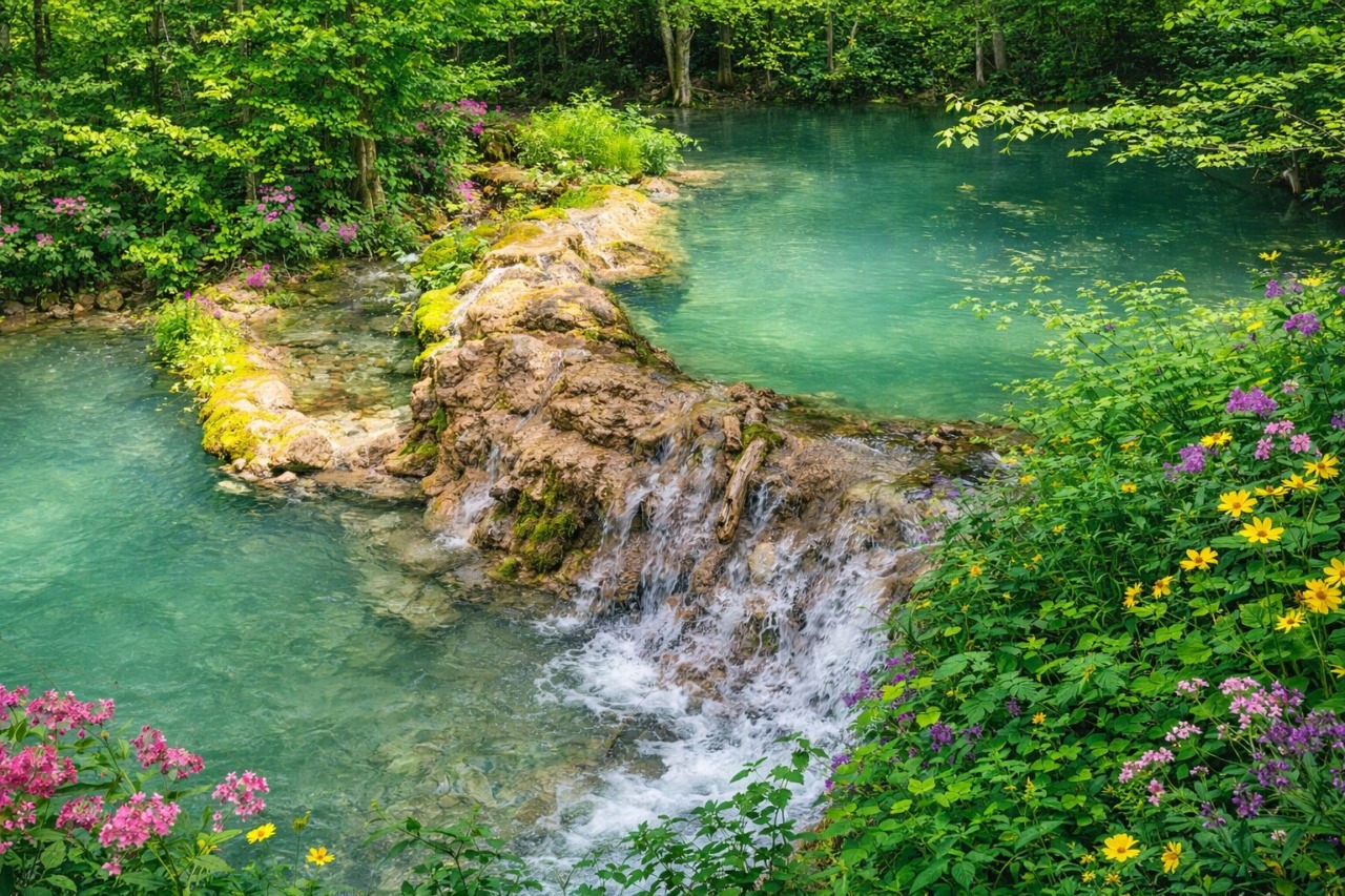
Turquoise Forest Spring
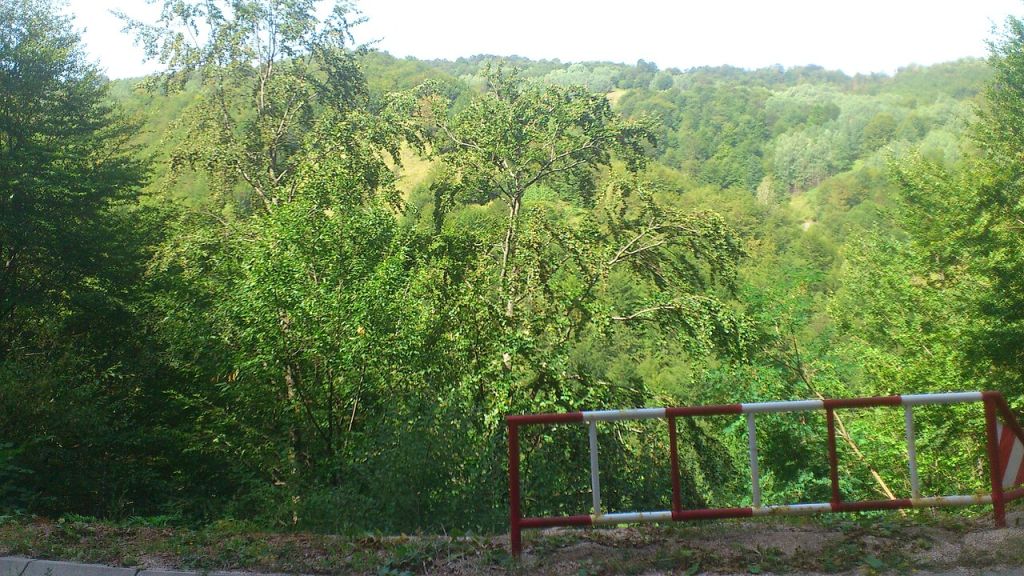
A small cascading spring flows through dense greenery in Stara Planina, surrounded by wildflowers and clear blue water
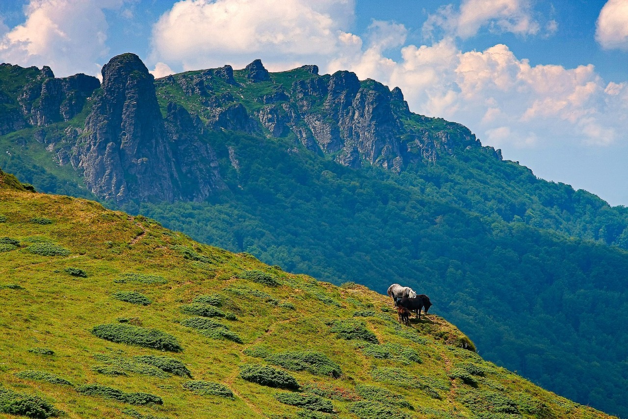
Rocky mountain ridge
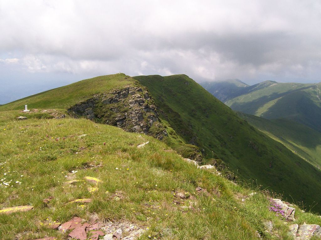
Grassy slopes and rocky peaks stretch across Stara Planina, with horses grazing near the edge of the hillside
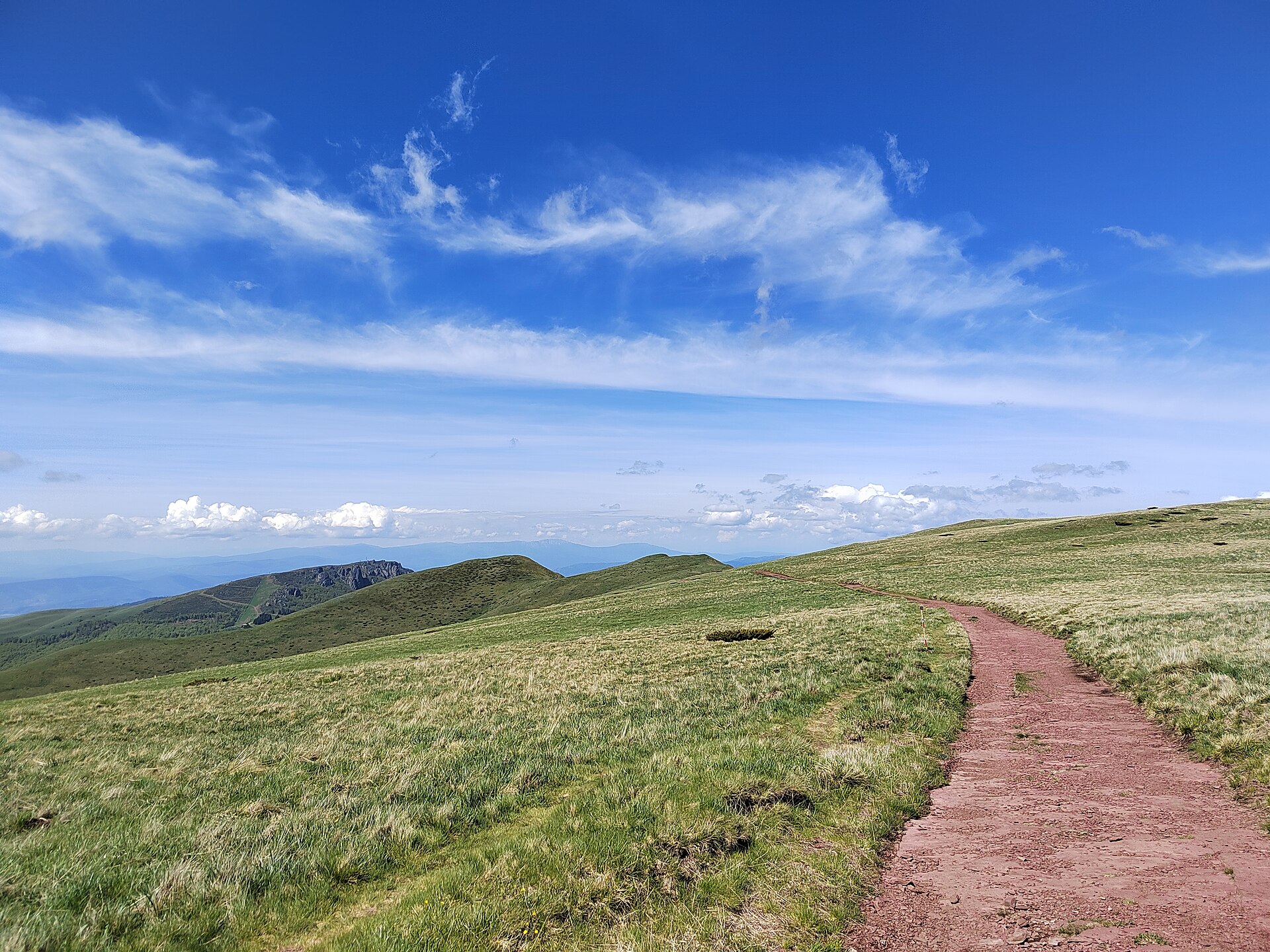
Mountain Trail and Meadows
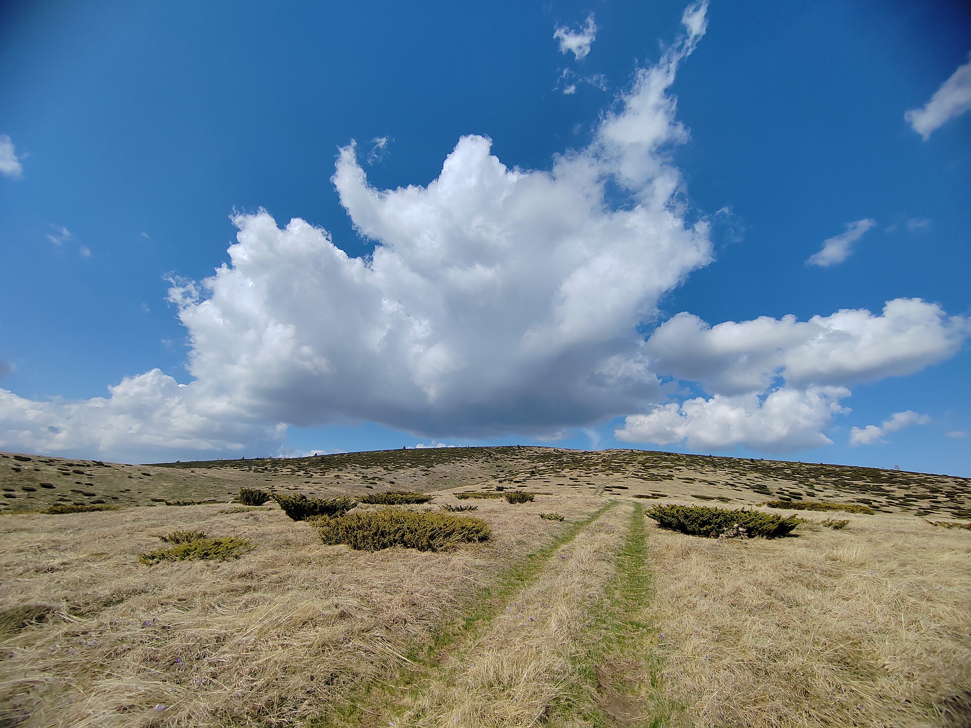
A red dirt trail crosses grassy alpine hills under a wide sky in Stara Planina
Mountain valley meadow
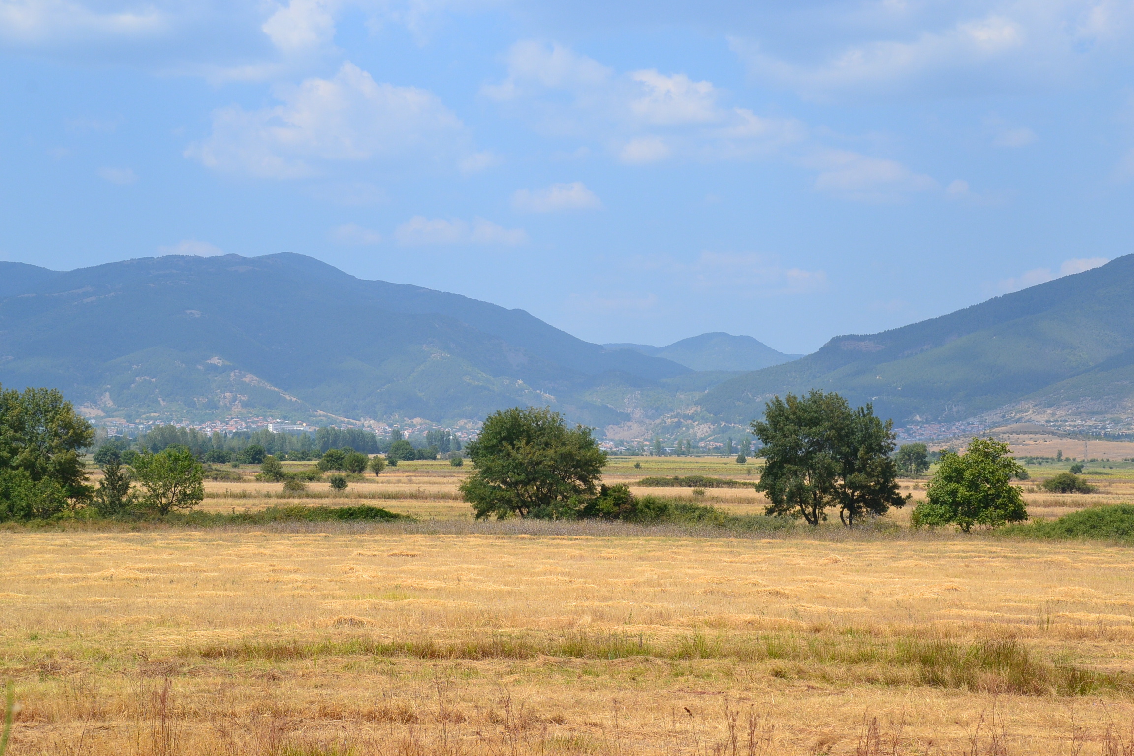
Dry meadow stretches across Stara Planina, with scattered trees, distant village buildings, and layered mountain ridges
Grassy Highland Meadow
Open grassy slopes and a faint track stretch across Stara Planina beneath large drifting clouds
Đavolja varoš (Devil's Town), 89 km from Niš, is a 67-hectare natural reserve declared in 1959 and classified as a natural phenomenon in 1995. The site contains approximately 200 rock formations rising 2 to 15 m above the surrounding landscape — the result of geological erosion, though local legends offer more elaborate explanations involving petrified wedding parties and forest spirits.
Two springs at the site have documented mineral properties: the Djavolja voda (Devil's Water) emerges at pH 1.5, with a mineral concentration 10 to 1000 times higher than drinking water, including iron, potassium, copper and nickel. The Crveno vrelo (Red Spring) is less acidic but has stained its surrounding rock deep red. In the 13th century, Saxon miners worked the area for iron ore and also found copper, zinc and smaller amounts of silver and gold; three of their mine shafts still exist, with one having been explored.
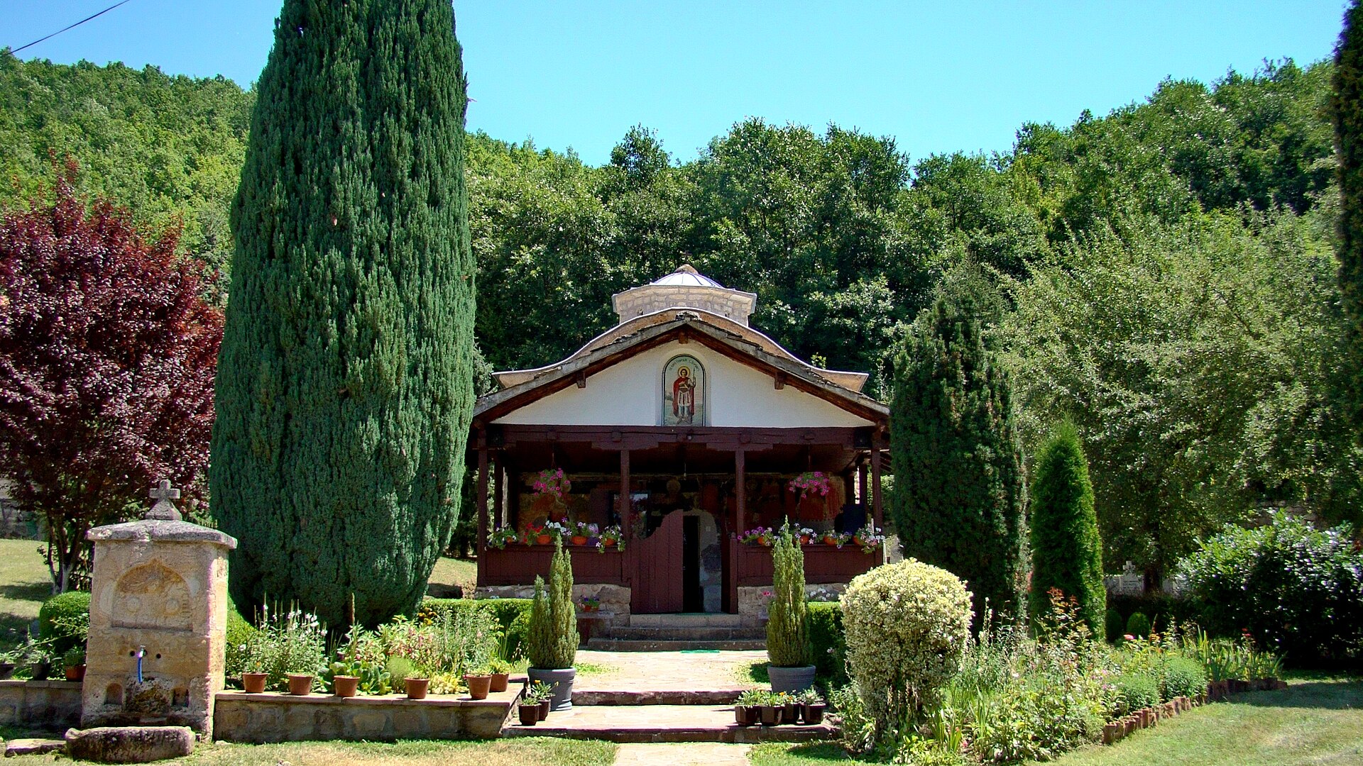
The cave church at Rsovci, in a hill outside the village, has operated since the 13th century as a shrine for pilgrims and hermit monks from Sinai. Its most distinctive feature is a fresco depicting the young Jesus as bald — an unusual iconographic choice. To enter, visitors must collect the key from a villager named Milutin, near the bridge before the village, or look for the sign 'Ključ od crkve'.
Summer and early autumn (June to October) provide the clearest conditions for hiking and driving routes. Spring — particularly April and May — offers the best view of Zavoj Lake when snowmelt keeps the water level highest; this is also when the meadow wildflowers are at their most varied. Winter brings ski conditions at the Babin Zub ski centre; road conditions on the mountain require winter tyres and, on some routes, chains.
The Planinarski dom Dojkinci, a mountain hut opened in 2019 by the Pirot tourism office, sits directly beside the Dojkinačka Reka river and near the Tupavica waterfall. It offers dormitory places and apartments, a self-catering kitchen, and a fireplace. Booking is by email through top010@mts.rs.
Drawing on Matthias Pasler's Serbia Travel Pocketbook: Gostuša, built entirely from local stone and natural materials, received the EU Heritage / Europa Nostra prize in 2016 for its restoration methodology. It is one of the few villages of its type where the original construction techniques were maintained throughout the renovation rather than replaced by modern equivalents.
Use this map to orient yourself around the main sights and surrounding area.
The main natural sites are spread across the mountain; a car is needed to reach most trailheads, viewpoints, and the cave church at Rsovci.
Midžor
At 2,169 meters, Midžor is the highest peak of Stara Planina and one of Serbia’s classic mountain goals. The summit rewards hikers with sweeping views across the border region and a real sense of the mountain’s scale.
Babin Zub
This distinctive rocky formation is one of the symbols of Stara Planina. It is popular with hikers and sightseers alike, and the surrounding area is also linked to the mountain’s ski infrastructure.
Bigar Waterfall and Valley
Bigar is one of the most photogenic natural spots in the region, where water spills over mossy stone in a lush setting. It is an easy and rewarding stop for travelers exploring the mountain by car.
Temštica River Meanders
The winding curves of the Temštica River create one of the area’s most scenic landscapes. It is a favorite for panoramic photography and a reminder that Stara Planina’s beauty is not limited to its highest peaks.
Jelovičko Vrelo
This spring is known for its striking, eye-like shape set among rocks. It is a quieter natural attraction, ideal for travelers who enjoy lesser-known stops and unusual geological features.
Temska Monastery and Donja Kamenica Church
These two religious landmarks offer a cultural counterpoint to the mountain scenery. Temska Monastery is known for its herbal tradition, while the church in Donja Kamenica preserves valuable medieval art and architecture.
Eastern Serbia, near the Bulgarian border
Midžor, 2,169 m
June–October for hiking; December–March for skiing
Mountain scenery, waterfalls, hiking, and ski tourism
Protected Nature Park
Knjaževac, Pirot, and Zaječar
2–4 days
Getting there: Stara Planina is reached by car from Pirot (eastern approach) or Knjaževac (northern approach). From Belgrade, allow roughly 4–5 hours depending on route; from Niš, approximately 1.5 hours to the lower mountain villages. Public buses run to Pirot and Knjaževac; onward travel to trailheads and rural sites requires a car or taxi.
Getting around: A rental car provides the most flexibility. Mountain roads are narrow and winding; allow more time than GPS estimates suggest, particularly on the upper plateau roads. Fuel up in Pirot or Knjaževac before heading up. Mobile coverage is inconsistent above 1200 m. Download offline maps before departure.
Practical information: The Pirot tourist office (Srpskih vladara 77, T 010 32 08 38, www.topirot.com) provides current trail conditions and can arrange guided activities. The website www.jpstaraplanina.rs lists all hiking routes and ski conditions with downloadable maps.
Yes. The mountain is an excellent destination year-round for hiking, scenic drives, waterfalls, photography, village stays, and cultural visits.
For most travelers, yes. Public transport can get you to nearby towns, but a car makes it much easier to reach natural attractions, trailheads, and rural accommodation.
There are options for different fitness levels, from short scenic walks to demanding summit hikes such as Midžor. Always check route conditions and weather before setting out.
It is possible from Niš or nearby towns, but an overnight stay is better. The mountain’s distances, winding roads, and number of sights make it more enjoyable over at least two days.
Look for traditional mountain food such as local cheeses, grilled meat, pies, homemade soups, and herbal products. In village households and smaller guesthouses, meals are often simple, fresh, and very satisfying.
Use this guide to choose your base, plan your sightseeing, and build a smarter Serbia itinerary.
Stay connected in Serbia