At a glance
Đerdap National Park stretches for 100 km along the right bank of the Danube in eastern Serbia, from Golubac Fortress to the Đerdap I hydroelectric dam. Officially established in 1974, it covers nearly 638 km² and was designated a UNESCO Global Geopark in 2020, together with the surrounding Miroč and Kučaj massifs — a total area of 1,330 km².
The park takes its name from the Turkish word girdap, meaning whirlpool. The alternative name — Iron Gates — was used by Romans and Slavs and describes the narrow gorge where the river cuts through steep limestone cliffs. At Mali Kazan, the deepest point of the Danube in the entire gorge, the river reaches approximately 95 metres depth, making it the deepest point on the continent's river system.
Within the park: more than 1,100 plant species, 150 bird species, 55 mammal species, 60 fish species, and 13 amphibian species. The prehistoric site of Lepenski Vir, the Roman Tabula Traiana, and the medieval fortress of Golubac are among the historical markers within or adjacent to the park boundaries.
Why Đerdap feels different from other national parks
The gorge of the Iron Gates (Đerdapska Klisura) forms the stretch between Donji Milanovac and Kladovo. For centuries the Danube was one of the most difficult sailing routes in Europe along this passage — steep cliff walls, narrow corridors, and unpredictable currents made navigation hazardous. Traffic was once managed by six signal-balloon stations acting as river traffic signals; the former station sites at Pena and Varnica remain as landmarks.
The construction of the Đerdap I hydroelectric dam, shared between Serbia and Romania and completed in 1972, raised the river level significantly and transformed the landscape. The Tabula Traiana, the Roman stone tablet carved into the cliff face, had to be relocated vertically before the flooding. Lepenski Vir, the prehistoric settlement, was physically moved 30 metres higher and several hundred metres upstream to prevent submersion.
Today the gorge is most directly appreciated from the road or bicycle path that runs along the riverbank. The section between Donji Milanovac and Kladovo is considered the most visually striking stretch, with cliff walls rising to 300 metres on each side and the river narrowing at its tightest point to around 150 metres — a figure that, even after the dam raised water levels, still makes the walls appear very high.
Hiking trails and walking routes worth your time
The park's highest viewpoints — Veliki Štrbac at 768 metres, Kovilovo at 358 metres, and Ploče at 355 metres — offer some of the widest perspectives on the Danube gorge available anywhere along the river. Walks to these points are managed through the national park; independent access requires prior registration. Rangers lead guided walks and are familiar with routes that go beyond the main trails.
The Danube cycle route (EuroVelo 6) passes through the park along the river, and the section through the Iron Gates gorge is one of the more demanding and scenic stretches of that continental route. Cyclists who travel the gorge can stop at will — an advantage over bus travel — though the road demands attention to driving traffic.
Geology, river power, and the shape of the Iron Gates
The Đerdap gorge represents Europe's largest river-cliff landscape. The deep cutting of the Danube through the limestone and sandstone massifs of Miroč and Kučaj occurred over geological time, leaving a layered record visible in the cliff faces. In 2020, the entire geological area — park plus surrounding massifs, 1,330 km² in total — received designation as a UNESCO Global Geopark, a category for landscapes of global geoscientific significance.
At Mali Kazan, roughly 30 km downstream from Donji Milanovac, the gorge narrows most and the river reaches its greatest depth — approximately 95 metres. This is the deepest point of the Danube and the deepest measured depth on any river in Europe. The cliffs at this point reach up to 300 metres above the water surface.
Useful stops around Đerdap
Key sites within and around Đerdap National Park, from prehistoric Lepenski Vir to the Roman Tabula Traiana and the town of Kladovo.
Golubac Fortress
A strong entry point to the Danube corridor before the road turns fully into gorge country.
Good for combining medieval history with river views. It pairs naturally with the park on a western approach.
- Link the fortress visit with a Danube drive, Useful first stop if you come from Belgrade, Works well with a half-day or full-day eastern Serbia plan
Lepenski Vir
One of the most important archaeological sites in the gorge corridor.
It gives the river a human timeline and helps explain why the Danube has mattered here for so long.
- Best paired with a park day, Adds prehistoric context to the river landscape, Useful for travelers who like museums and open-air sites
Kladovo
A practical base on the eastern side of the park.
Handy for overnight stays, slower mornings, and access to the river section near the border with Romania.
- Good for a two-day visit, Simple base for viewpoints and trail starts, Useful if you are continuing along the Danube
How to shape the visit
Focus on one side of the gorge, two or three viewpoints, and one short trail. Keep the pace steady. The road between stops is part of the enjoyment, and the river views change enough to keep the day moving without feeling rushed.
Use Kladovo, Donji Milanovac, or a nearby Danube base, then spread the visit across morning and late afternoon light. That gives you time for hiking, geology stops, and the kind of pause that makes the park feel larger.
Practical tips for visitors
Donji Milanovac is the main base for visiting the national park. The town itself consists largely of panel-block housing — it was relocated in 1970, 6 km downstream from its previous position, when the Đerdap I dam raised water levels. Despite its functional appearance, its position inside the park makes it practical as a starting point. The Đerdap Information Centre, opened in 2019, is the main resource for planning visits and booking guides.
Kladovo, at the downstream end of the gorge, is the other main access point. The journey between Donji Milanovac and Kladovo — by bus, car, or bicycle — passes through the most dramatic section of the gorge. Boat tours operating from Tekija, between the two towns, cover several highlights including the submerged monastery Mrakonjia and the stone carving of the Dacian king Decebalus on the Romanian bank (more clearly visible from the Serbian side than from Romania).
The Tabula Traiana, a Roman stone plaque approximately 4 by 1.7 metres carved into the cliff face, marks the course of the Via Traiana road built by Emperor Trajan for his campaigns against the Dacian king Decebalus. When the dam was constructed, the tablet was moved to a higher position — and to a different location in the cliff.
Landscape details to notice
These are the views and textures I would keep an eye on when you are in the park.
River pinch points
Places where the Danube narrows and the gorge feels most compressed.
Rock faces and strata
Exposed stone layers that make the geology easy to read from the road or a lookout.
Forest slopes above the water
Shaded hillsides that soften the severe edges of the canyon.
Where Đerdap sits on the Danube
Use the map to orient yourself along the Iron Gates corridor before you choose a base, a trailhead, or a river stop.
Quick facts for planning
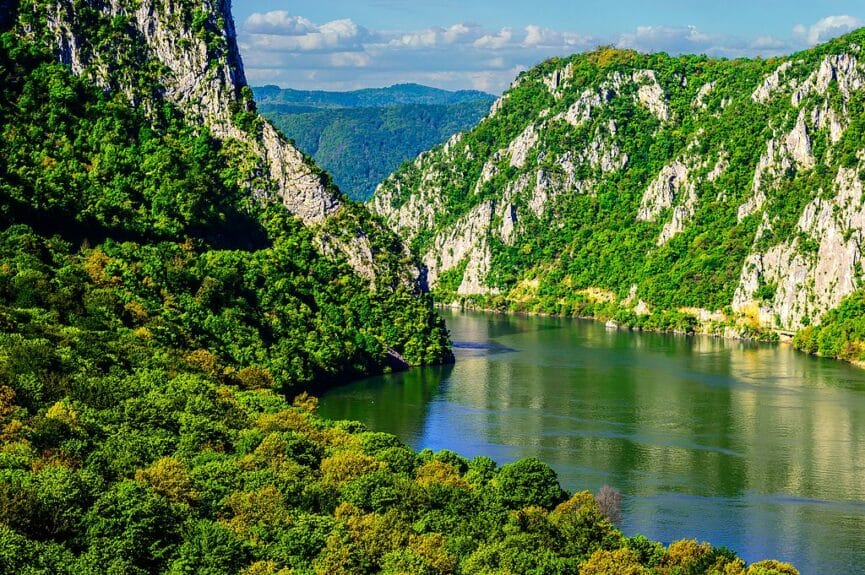
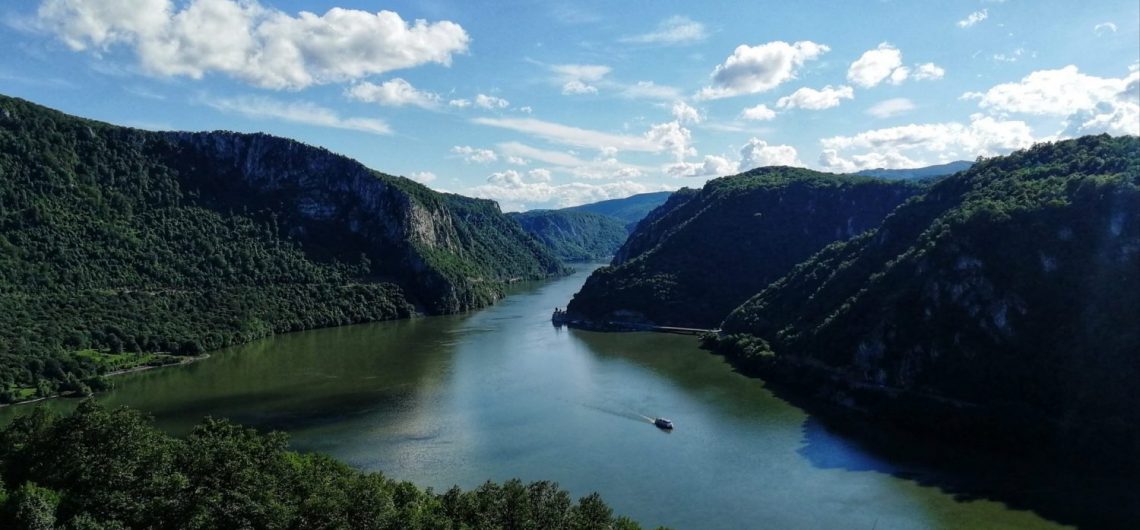
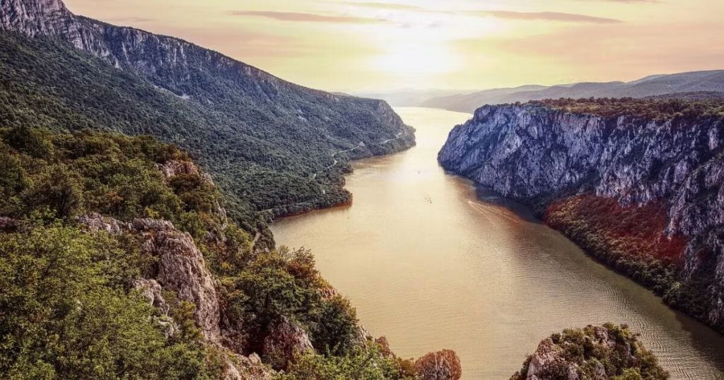
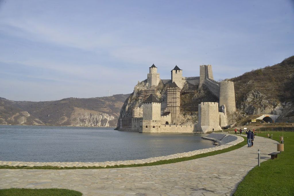
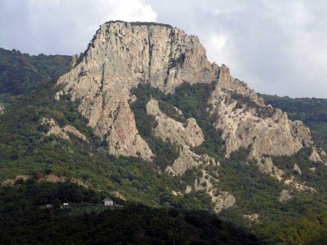
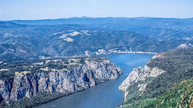
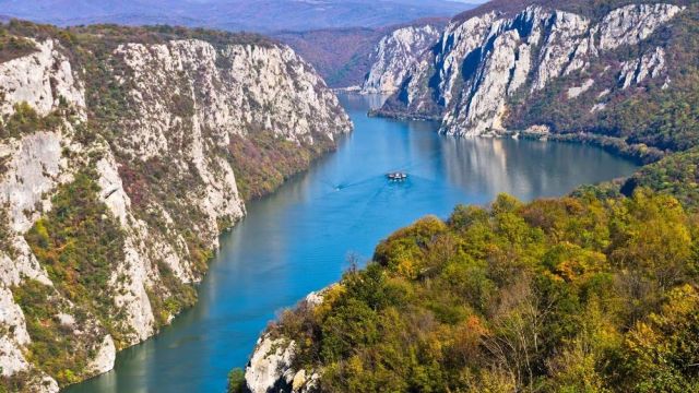
Eastern Serbia, on the Danube
Kladovo for the eastern side, Golubac or Donji Milanovac for western approaches
Good for hiking, scenic drives, river viewpoints, and geology-focused stops
<a href="/serbia/the-majestic-djerdap">Đerdap overview</a>, <a href="/serbia/eastern-serbia">Eastern Serbia guide</a>, <a href="/serbia/navigating-the-danube-serbia-s-lifeline-2">Danube in Serbia</a>
Plan a full day at minimum, or two days if you want trail time and the river coast
Quiet, wide, and shaped by water, limestone, and wind
Drawing on Matthias Pasler's Reise-Taschenbuch Serbien: visits to viewpoints, caves, and guided hikes inside Đerdap National Park require advance registration — at least three days ahead — by email or phone with the national park administration (office@npdjerdap.rs). The park entrance fee is 250 RSD per person; a licensed guide costs 3,600 RSD. Boat tours departing from Tekija allow passengers to see the Tabula Traiana, the Decebalus rock carving on the Romanian bank, and several submerged ruins.
Frequently asked questions
How much time should I set aside for Đerdap National Park?
Plan at least a full day if you want viewpoints and a short walk. Two days works better if hiking is important to you or if you want to pair the park with Golubac, Lepenski Vir, or a Danube overnight in Kladovo.
Is Đerdap better for hiking or for scenic driving?
Both. The road defines the visit, but the trails give you a stronger sense of the gorge. Many travelers do a scenic drive first, then choose one walk or viewpoint that fits their energy level.
What kind of traveler enjoys the park most?
People who like landscapes with scale, geology, river history, and slower movement between stops tend to enjoy it most. It is also a strong choice for travelers building a Danube itinerary through eastern Serbia.
Should I link Đerdap with other Serbian destinations?
Yes. It connects naturally with Golubac Fortress, Smederevo, the broader Danube route, and the wider Eastern Serbia guide. That makes the trip feel more complete and much easier to plan.
Lepenski Vir, the prehistoric site within the park, was discovered by archaeologist Dragoslav Srejović in excavations carried out between 1965 and 1970 — timed to precede the dam construction and the flooding of the valley. The site spans 2,500 m² and contains settlement layers across different eras, with the earliest finds dating from approximately 9,500 years ago. The modern visitor centre, opened in 2011 under a large glass structure, includes a 1:1 reconstruction of the settlement and original objects recovered during the digs.
Build your eastern Serbia route around the Danube
Combine Đerdap with Golubac, Lepenski Vir, and a base in Kladovo or Donji Milanovac, then let the river decide the pace of the day.