At a glance
The Danube crosses northern and eastern Serbia before narrowing into dramatic gorges in the east. In practice, that means an easy city riverfront in Belgrade, a fertile plain near Novi Sad, fortress viewpoints at Golubac, and protected landscapes inside Đerdap National Park. The river works well for self-drive trips, guided excursions, cycling segments, and short boat cruises.
Navigating the Danube in Serbia: National Parks, River Features
Discover more about Navigating the Danube in Serbia: National Parks, River Features.
River features to notice as you travel
In Belgrade, the meeting point of the Sava and Danube shapes promenades, fortress views, and riverbank walks. It is the most accessible place to read the river from the city.
Further east, Đerdap brings steep walls, tighter bends, and long views across the water. This is the section many visitors come for when they want a more scenic Danube experience.
Best places to stop along the Danube
These stops combine practical access with a clear sense of the river corridor.
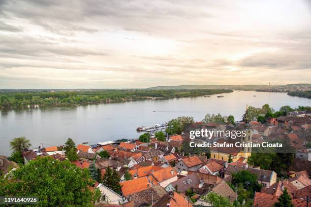
Belgrade riverfront and Kalemegdan
Start with the city where the rivers meet.
Walk the fortress terraces, look over the confluence, and use the riverfront as your first orientation point for a Danube trip.
- Easy access by foot, Fortress views, Museum and park breaks
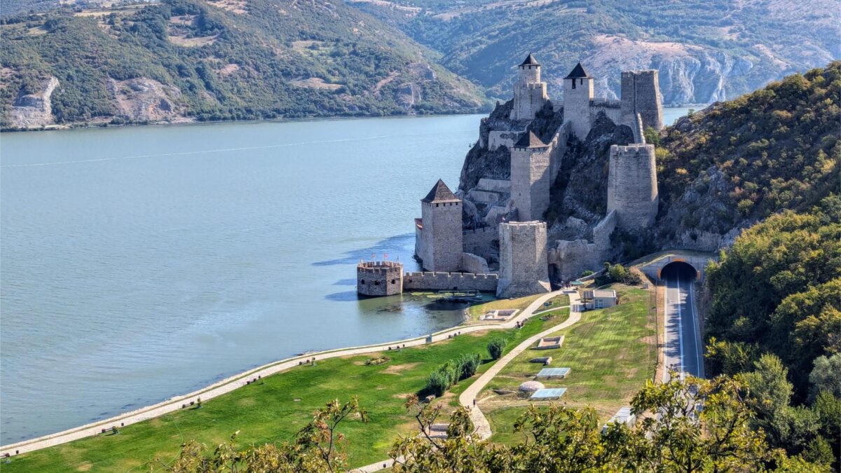
Golubac Fortress
A strong river landmark near the gorge approach.
Golubac sits close to the water and gives a clear sense of how the river has shaped defense, trade, and movement.
- Photogenic shoreline setting, Good day-trip stop, Pairs well with Đerdap
Đerdap National Park
The deepest nature stop on the route.
Use the park for gorge views, viewpoints, hiking, and boat outings. It is the key destination for the eastern Danube section.
- Protected river landscape, Cliffs and viewpoints, Boat and hiking options
Navigating the Danube in Serbia: National Parks, River Features
Discover more about Navigating the Danube in Serbia: National Parks, River Features.
A simple 3-day Danube route
This route keeps transfers manageable and leaves room for viewpoints and meals.
- Walk Kalemegdan and the riverfront
- See where the Sava meets the Danube
- Stay overnight in Belgrade or Zemun
- Drive east along the river corridor
- Stop at Golubac Fortress
- Add short viewpoints and village lunch stops
- Choose a boat ride or scenic drive
- Pause at gorge viewpoints
- Keep time for a slower return journey
Danube route map
Use this map to orient the main Danube corridor from Belgrade east toward Golubac and Đerdap.
Quick facts
Slow travel, fortress stops, nature drives, and Danube viewpoints
Đerdap National Park for gorges, cliffs, and river scenery
Belgrade for access; Novi Sad for a northern river stay
Frequently asked questions
Can I travel the Danube in Serbia without a car?
Yes, but it is easier in parts than others. Belgrade is walkable, and some excursions run from the city. For Golubac and Đerdap, a car or guided transfer makes the route simpler.
Which section of the Danube is best for scenery?
The eastern stretch near Đerdap is the most distinct for river scenery, with cliffs, bends, and viewpoints. The Belgrade section is better for city views and river confluence landscapes.
Where should I start if I only have two days?
Start in Belgrade, then choose either Golubac or a shortened Đerdap day trip. That gives you a balanced mix of fortress history and river landscape.
How does this route connect with other Serbia guides?
It links naturally with Belgrade, Eastern Serbia, Golubac Fortress, and the main Serbia country guide, which makes it easy to expand into a longer itinerary.
Build your Serbia route around the Danube
Start with the river, then add the city, fortress, and park stops that suit your pace. If you are planning a longer trip, use the Danube as the spine and branch into nearby Serbia regions from there.