
Rtanj Mountain
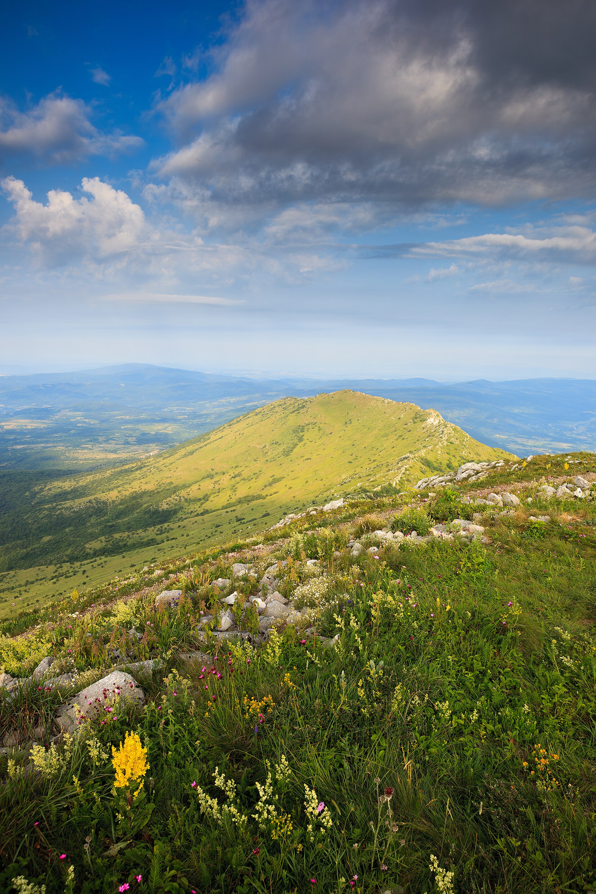
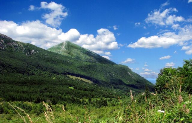
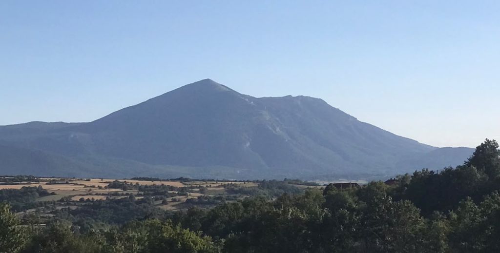
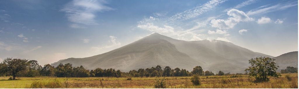
Rtanj Mountain rises as a long limestone mass with a sharply pointed end that gives it the profile many travelers call the Serbian pyramid mountain. Official tourism material places it near Boljevac, on the northern edge of the Sokobanja valley, with bare upper slopes and a broad mountain body that dominates the surrounding landscape. It is most closely associated with the summit zone around Šiljak, while the overall feel is exposed, quiet and weather-led rather than resort-like.
The pyramid profile and Šiljak summit hike
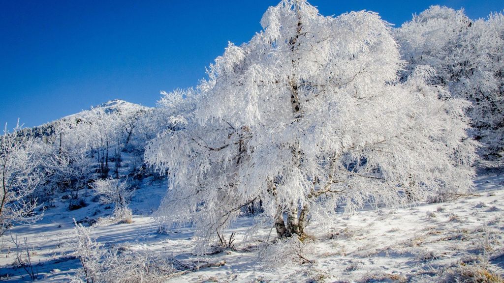
What makes Rtanj specific is not just that it is a mountain you can hike, but that it offers one clear visual idea from far away and one clear objective once you are on it. The triangular silhouette is what draws first-time visitors; the summit route to Šiljak is what turns that curiosity into an actual travel plan. Official sources describe self-guided hikes of varying difficulty rather than a single promenade route, which means the experience stays close to mountain logic: choose a side, judge the weather, manage your energy, and aim for the top where the remains of the former Church of St. George mark the summit area.
Why Visit Rtanj Mountain
Rtanj draws people who want a mountain that is straightforward in concept but not softened into a resort product. You come for a summit objective, open views when conditions allow, and a route choice that can be adapted to your fitness and confidence. The mountain is also one of the places in Serbia where landscape and folklore meet: its near-geometric outline has given it a lasting mystical reputation, but the actual visit is physical and practical rather than staged.
For road trippers, Rtanj works well as a crossover stop between the longer mountain loops of Western Serbia and the spa-and-canyon routes farther east. The official Rtanj material does not present a bundled experience with tickets, timed entry or fixed activities. That is useful in itself, because the quality of the day depends on weather, footwear, daylight and route choice more than on any facility at the destination.
Where Rtanj Is and How to Get There
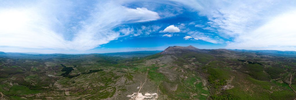
Rtanj is not a fenced attraction with one postal address or a staffed gate. Official tourism pages place it near Boljevac and on the northern edge of the Sokobanja valley, so most visitors approach by road from one of those two sides. If you are flying or arriving by intercity transport, Niš is the most practical big-city reference point in southern Serbia, while drivers from Belgrade usually add Rtanj to a longer mountain circuit.
Public-transport details to the mountain itself are not published on the official Rtanj pages, and neither are trailhead parking rules or local taxi fares. For bus and rail legs into the wider area, use the Serbia transit search first, then plan the final road transfer from Sokobanja, Boljevac or a nearby lodging. If you do not know the routes, contact a local tourist office before departure rather than assuming that every trailhead works the same way year-round.
Rtanj Hiking Guide: Peaks, Trails and Difficulty
The official guidance for Rtanj is broad but important: this is a self-guided mountain visit with trails of varying difficulty, and ascent time changes with route choice and weather. That means the first planning decision is not what ticket to buy, but whether your group has the fitness, footwear and route confidence for a summit day.
Šiljak as the main objective
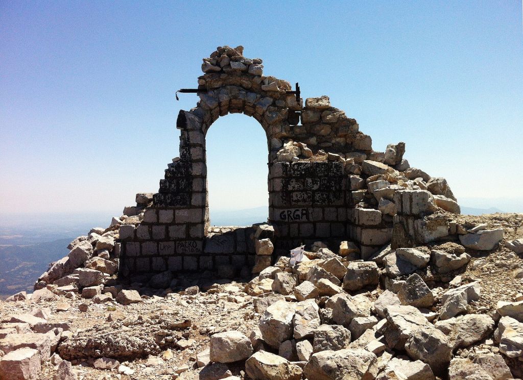
Šiljak is the highest point of Rtanj. Official sources differ slightly on the exact figure, reporting it at 1,560 or 1,565 metres, which is close enough in practical terms to tell you what matters: you are climbing a serious summit rather than taking a short viewpoint stroll. The summit area also contains the remains of the former Church of St. George.
How hard is hiking Rtanj
Because the mountain is presented through multiple trails rather than one uniform route, difficulty depends on where you start and how directly you aim for the top. What does not change is the exposure of the upper mountain and the need to manage the hike as a real hill day. Proper equipment is specifically mentioned in the official material. If you are inexperienced and unfamiliar with the trails, an experienced guide is mandatory according to the published visitor information.
Who Rtanj suits best
Rtanj is best for active travelers who are comfortable with an early start, changing weather and a walk that may take several hours in each direction depending on conditions. It is less suitable for visitors who want guaranteed facilities, marked urban-style promenades or a fixed-duration attraction visit.
When to visit Rtanj Mountain and what to pack
Because Rtanj is an open mountain rather than a timed attraction, the best moment to go is driven by visibility, stable weather and the amount of daylight you have available. Clear days from spring to autumn are the easiest for first-time visitors, while very hot midsummer afternoons can make an exposed ascent feel harder than the distance alone suggests. Winter conditions can transform the mountain entirely and are better left to hikers with the right equipment and judgment.
Start early enough that you are not chasing the summit late in the day. Bring hiking boots or shoes with reliable grip, a wind layer for the exposed upper slopes, water, food, and sun protection. Trekking poles and a small daypack make sense for many visitors, especially if you prefer steadier footing on steeper sections. Since no on-mountain service pattern is published, pack as if you need to be self-sufficient for the whole hike.
What to expect at Rtanj Mountain
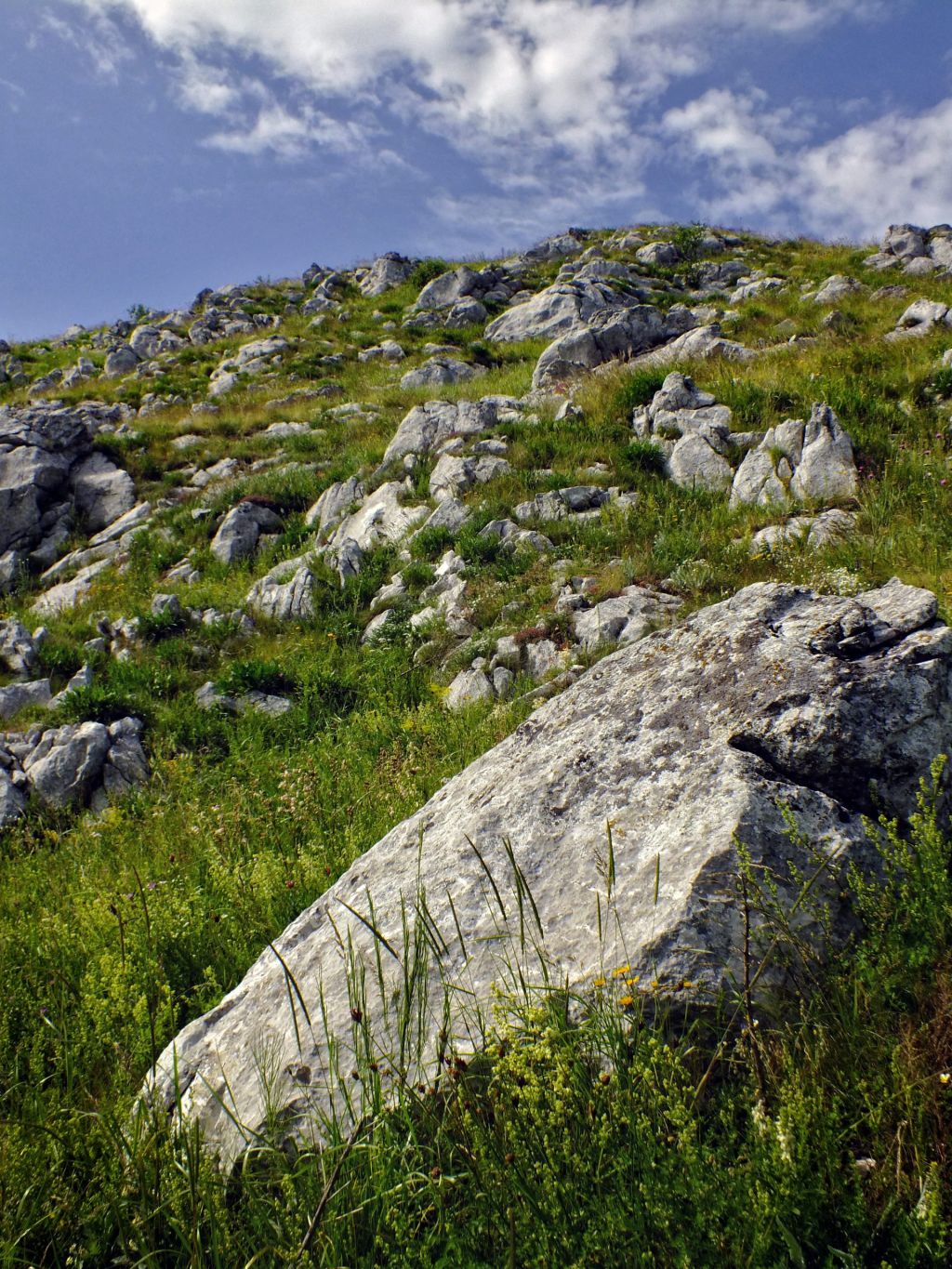
Expect a mountain atmosphere, not a visitor-center experience. Rtanj is quiet once you leave the approach roads, and the exposed terrain means the mountain can feel bigger and more serious than its well-known shape suggests. Dress for a hike rather than a sightseeing stop. Casual town shoes are a poor fit for the upper slopes.
Accessibility is limited by the nature of the terrain; this is not a wheelchair-friendly or stroller-friendly destination, and families with small children need to judge carefully whether a summit day matches their pace. The mountain suits independent walkers, small groups and road trippers who are happy carrying what they need. Bring layers, water, snacks, navigation support and a charged phone, because published on-site facilities are minimal.
Practical Tips for Visiting Rtanj Mountain Safely
Treat Rtanj as a real mountain day and not as a scenic roadside stop. Check the forecast, tell someone your plan, and avoid treating a late start as harmless just because the mountain is visually distinctive. The official advice is direct: proper equipment is needed, and if you are inexperienced and unfamiliar with the trails, an experienced guide is mandatory.
Before a self-drive day, run through the broader practical travel tips for Serbia that affect mountain outings, including road planning, cash, mobile coverage and general trip timing. For last checks, the Tourist Organization Sokobanja lists Monday to Friday, 07:00 to 15:00, phone +381 18 833 988 and email tic@tosokobanja.rs on its official Rtanj page. The Tourist Organization of the Municipality of Boljevac lists phone +381 (0) 30 463 593 and email office@visiteastserbia.com for additional information. No official online booking or reservation page for the mountain visit itself was found in the sourced material.
Sources and last checked
Sources cross-checked for this guide:
Last checked: 15 August 2026. Fact-checked by the editorial team led by Patrick against the official sources above, and reviewed before publishing.
Where to stay near Rtanj
Rtanj itself is an open mountain rather than a serviced resort, so most visitors sleep in a base town or a nearby lodging and drive to the access point.
Boljevac
North-side baseThe practical choice when you want a municipal base close to the mountain's Boljevac side.
- Official context
- Rtanj is placed near Boljevac on official tourism material
- Good for
- Simple overnight stays and a direct start toward north-side access
- Booking status
- Current lodging inventory varies by season
Sokobanja
South-side baseUseful when you want to combine the hike with a longer stay in a spa town setting.
- Official context
- Rtanj is placed on the northern edge of the Sokobanja valley
- Good for
- South-side approach plus town services after the hike
- Extra pairing
- Tourism material also mentions Sesalac Cave and the marble promenade
Nearby mountain lodgings
Closest overnightWorth checking if you want less driving on summit day and an earlier start.
- Check before booking
- Road access, meal options, heating and late-arrival policy
- Official booking link
- Not found
- Best for
- Early starts and two-day mountain plans
The official Rtanj tourism pages do not publish a single accommodation portal, on-mountain reception desk or standard reservation system.
How to get to Rtanj Mountain
Official pages give location context but not door-to-door trailhead schedules. Use this as a planning framework rather than as a substitute for checking conditions before departure.
Walking directions from individual trailheads are not standardized on the official pages, and ascent time varies by route and weather.
After Rtanj Mountain: how to extend the trip
Sokobanja tourism material pairs Rtanj with Sesalac Cave and evening walks on the marble promenade. That makes the south side practical if you want a hiking day followed by a town base rather than a remote overnight.
Rtanj fits neatly into a broader drive through Eastern Serbia, especially if you are moving between spa towns, caves and archaeological stops. It also works as a strong nature day when you are using a city base farther south and need a mountain break from urban time.
Where Rtanj Mountain is
Use the map to orient Rtanj between the Boljevac side and the Sokobanja valley before choosing your access point.
Best routes and bases on Rtanj Mountain
These are the four most useful named targets and approach ideas to understand before you choose your day on Rtanj.
Šiljak Summit
The main hiking objective on Rtanj.
Šiljak is the summit goal that turns Rtanj from a scenic detour into a full mountain day. Most first-time visitors plan around reaching this top rather than wandering the lower slopes without a clear target.
- Sub-location: upper summit ridge, Price band: no ticket published, Opening hours summary: open mountain terrain; plan for daylight, Best for: visitors who want the classic Rtanj objective
Ruins of the Church of St. George
Historic remains in the summit area.
Official Rtanj material notes the remains of the former Church of St. George near the top. They add a historic marker to the climb, but the draw is still the mountain setting rather than a staffed monument visit.
- Sub-location: summit zone, Price band: no ticket published, Opening hours summary: open access in mountain conditions, Best for: hikers already aiming for the top
Boljevac Side Approaches
A practical north-side planning frame.
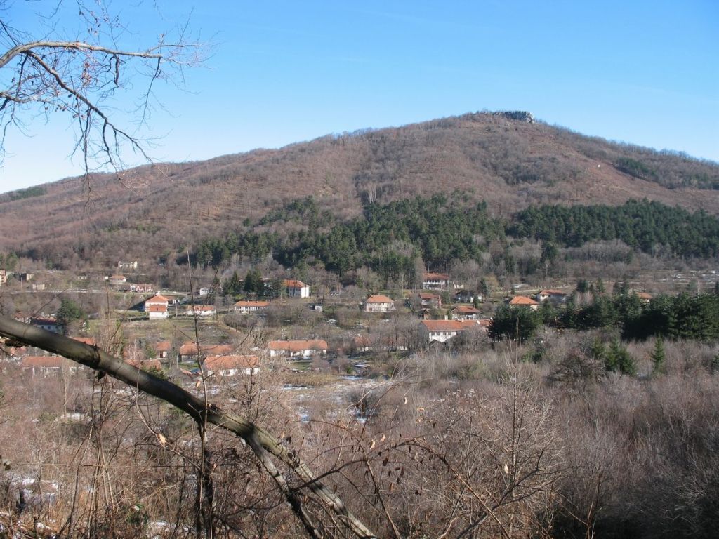
If you sleep in Boljevac, this side keeps the morning simpler and reduces backtracking. Official regional tourism information places Rtanj near Boljevac and presents it as a self-guided outing with multiple route choices.
- Sub-location: Boljevac side of Rtanj, Price band: trail access price not published, Opening hours summary: no fixed visitor hours published, Best for: overnight stays on the north side
Sokobanja Side Approaches
The most useful south-side base idea.
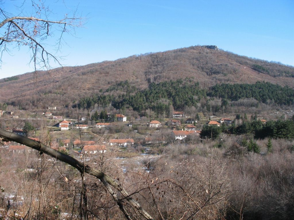
Sokobanja tourism material treats Rtanj as one of the nearby mountains on the valley's northern edge. This side suits travelers who want town services and a broader short-break base before or after the hike.
- Sub-location: north edge of the Sokobanja valley, Price band: trail access price not published, Opening hours summary: no staffed gate or fixed opening hours published, Best for: combining Rtanj with a spa-town stay
Quick facts about Rtanj Mountain
Rtanj Mountain near Boljevac; full postal address not published
Boljevac and the northern edge of the Sokobanja valley
Pyramid-shaped mountain profile and the hike to Šiljak
No entry price published
Clear-weather daylight visit, usually spring to autumn for first-time hikers
Not published
An experienced guide is mandatory if you are inexperienced and unfamiliar with the trails
+381 18 833 988, tic@tosokobanja.rs; +381 (0) 30 463 593, office@visiteastserbia.com
Guide requirement on Rtanj
Official tourism material says that if you are inexperienced and unfamiliar with the trails, an experienced guide is mandatory.
Gear for Rtanj Mountain
Published advice is simple: proper equipment is needed. For most visitors that means hiking boots with grip, layers for wind on the exposed ridge, water, food and a charged phone.
Road-trip reality
Rtanj works better with your own car or a pre-arranged transfer than with spontaneous last-minute public transport because mountain-side last-mile details are not published on the official pages.
Common questions about Rtanj Mountain
Is Rtanj Mountain a paid attraction?
No official entry ticket or standard admission price was found in the sourced material. Rtanj is presented as an open mountain visit rather than a ticketed site.
Do I need a guide for Rtanj?
If you are inexperienced and unfamiliar with the trails, official tourism material says an experienced guide is mandatory.
Can I book Rtanj online?
No official online booking or reservation link for the mountain visit itself was found in the sourced material.
What is the main summit on Rtanj called?
The main summit objective is Šiljak. The summit area also contains the remains of the former Church of St. George.
Can Rtanj be visited from Sokobanja?
Yes. Official Sokobanja material places Rtanj on the northern edge of the Sokobanja valley, making the town a practical south-side base.
Need help planning Rtanj and nearby mountain days?
Serbian Travel can help you shape a route that combines Rtanj with the right base, transport rhythm and nearby stops.