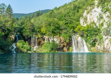
Sopotnica bb, 31305 Sopotnica, Serbia

Sopotnica works best as a deliberately scoped outdoor visit. The shorter choice concentrates on the settlement, surviving mill landscape and waterfall viewpoints; the wider choice enters the Jadovnik hiking network and needs separate route planning. No current official circuit distance, ascent, standard duration, admission price or universal access season is published. Independent visitors should establish local conditions before departure rather than treating online map labels as a complete trail plan.
Sopotnica occupies the slopes of Jadovnik above the Lim Valley, with Prijepolje serving as the regional gateway. The settlement is dispersed rather than arranged around a managed visitor centre: houses, farm plots, stream crossings and timber structures form part of the same inhabited terrain. Water descends through this village fabric before continuing toward lower ground, so orientation begins with understanding the settlement rather than locating a single entrance gate. Within Western Serbia's mountain and monastery region, Sopotnica is defined by the close relationship between flowing water and rural infrastructure. The atmosphere is that of a working village, not a landscaped waterfall park.
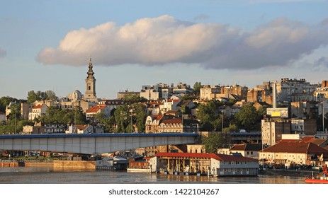
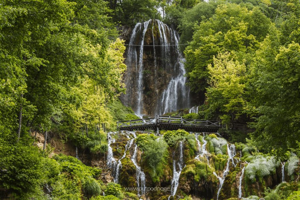
The defining experience is not one isolated drop but a water-shaped cultural landscape. Cascades occur above and through the village area, while old timber mills stand along the same course. That pairing distinguishes the Sopotnica waterfalls from a roadside viewpoint where visitors stop for a single panorama. Here, the useful details are small and sequential: the way channels divide, the position of a mill beside moving water and the transition from inhabited ground toward the upper falls. The Sopotnica watermills should be observed as heritage structures, not assumed to be staffed exhibits. A self-guided visit can follow this relationship without turning the outing into a longer Jadovnik expedition.
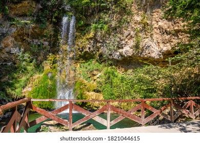
The waterfall complex received protected natural-monument status in 2005. That identity covers a landscape rather than a built attraction with a controlled indoor route, and it changes how the visit should be approached. The streams, cascades, vegetation and traditional structures belong to one connected setting; stepping away from an obvious viewpoint can therefore affect both natural features and village property. Historical descriptions do not give a consistent protected-area size, so a precise hectare figure is not useful for trip planning. What matters on the ground is restraint: remain on evident or locally confirmed paths, avoid disturbing channels and banks, and leave the Jadovnik waterfalls without moving natural material.
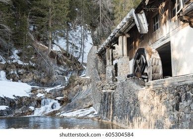
The mills make the river legible as part of village history. Their placement beside flowing water shows how the landscape once supported practical food production as well as shaping paths and settlement patterns. Timber construction also allows the buildings to sit lightly beside the channels, but age and exposure mean that appearance alone cannot establish whether a structure is safe, open or still functional. There is no published schedule for demonstrations or interior visits. Observe the Sopotnica watermills from public or clearly permitted ground, and ask locally before approaching doors, machinery or adjoining farm space. The value of the mills lies in their relationship with the river and village, even when entry is unavailable.
Approach Sopotnica through the Prijepolje area, which is the practical regional gateway for the village and Jadovnik. The checked visitor information does not publish a local bus line number, a timetable to the waterfall area or a signed public-transport connection for the final approach. No validated walking route or walking time from a named Prijepolje landmark is available either. Travellers without a car should arrange local road transport in advance and agree on the return, because a typical taxi fare has not been published.
Current road condition, the final drop-off point, formal parking capacity and any parking charge are also not published. Ask the Tourism Organisation of Prijepolje to confirm the latest approach before setting out, particularly after poor weather. Do not base arrival timing on an unverified transfer estimate.
A universal visitor season for Sopotnica has not been published, and recommendations used for other southwestern Serbian destinations should not be transferred automatically to the waterfalls. Choose a day only after checking current weather, water and path conditions locally. Arriving with sufficient daylight is more useful than targeting a particular weekday, because there is no established opening window, staffed entrance or official quiet period to plan around. Reservation information is not published for the outdoor waterfall landscape. Any meal, hosted village experience or overnight stay is a separate arrangement and should be confirmed before departure.
Sopotnica is an outdoor rural setting rather than a managed visitor attraction with railings, surfaced circuits and guaranteed facilities. No formal dress code applies, but clothing should suit changeable mountain conditions and ground that has not been documented as universally level or accessible. Wheelchair access, step-free viewpoints, handrails and adapted toilets are not confirmed. Noise levels and crowd patterns are not published, so visitors should not rely on the village being empty or silent.
Families need to judge conditions for each child rather than treating the falls as an automatically easy walk. Download any navigation material before arrival, keep enough time to reverse course and avoid entering a mill or crossing private land without permission.

Begin by orienting yourself within the village rather than immediately following the first uphill track. Establish which ground is public, where the watercourse passes through the settlement and which mill structures can be viewed without entering private space. From there, continue toward confirmed waterfall viewpoints, pausing where the relationship between channel, mill and cascade is visible. Return by the same understood route if markings become unclear.
This is an editorial sequence, not a measured or officially graded circuit. No reliable distance, ascent, walking duration or complete waymarking record has been established. It is therefore better to select a turning point from current local advice than to force a circular walk shown by an unverified app. The waterfall-first approach keeps attention on Sopotnica's defining landscape while leaving enough margin to respond to conditions.
The wider tourism hiking network names routes toward Katunić and the Mileševka area, placing Sopotnica within a much larger mountain landscape. Those connections should not be presented as extensions of a casual waterfall stroll. Before committing, establish the current marking, total distance, ascent, water exposure, weather implications and return plan for the exact route. None of those operational details is consistently published for an introductory visit.
Travellers building a broader southwestern itinerary can use Nova Varoš and the Uvac gateway as a separate regional base, but its access assumptions do not define conditions on Jadovnik. Make the longer walk only when route-specific information supports it; otherwise, finish with the village and waterfall area.

A mountain hut is identified near Sopotnica within the Jadovnik landscape, but its existence is not proof of a currently bookable bed. A year-round timetable, staffing pattern, room inventory, overnight price and list of included services are not published. There is also no confirmed online reservation link, telephone number or email address for a visitor booking. Contact the relevant mountaineering body through its Jadovnik information before relying on the hut.
Ask specifically whether accommodation is operating on the intended date, what sleeping equipment is needed, whether food or drinking water is supplied, when arrival is accepted and how payment works. Without a direct confirmation, plan the outing as a day visit with independent transport back from Sopotnica.
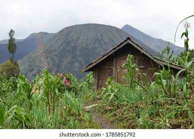
Food traditions connect the mills to household life. Local visitor material identifies pogača, a round home-style bread, alongside pies made with dairy ingredients, buckwheat or greens. These dishes belong to the village's hospitality culture and to the broader story of regional food in Serbia, where grain, cheese and seasonal fillings recur in different local forms.
The tradition should not be mistaken for a guaranteed restaurant menu. No daily service hours, fixed meal price, number of courses or walk-in dining venue is published for Sopotnica. If food is an important part of the visit, arrange it directly in advance and ask what will actually be prepared, at what time and for what price. Otherwise, regard the food history as cultural context rather than an included meal.
Reconfirm the approach road, path status, recent weather and any local warning shortly before departure. A mapped line does not establish that a route is marked, maintained or passable in every season. If local information is incomplete, reduce the scope of the outing rather than treating uncertainty as permission to continue.
Carry your own drinking water and do not assume untreated spring water is safe because it looks clear. Leave plants where they grow; descriptions of traditional or medicinal use are not an invitation to collect them. Pack out litter, avoid altering channels or banks and give residents room to use tracks and working land. These choices protect both the designated natural landscape and the ordinary village routines that give Sopotnica its character.
Sources cross-checked for this guide:
Last checked: 17 October 2026. Reviewed and fact-checked by the editorial team led by Nenad, using the official sources listed above.
Documentary information was checked on 9 October 2026. This was an automated editorial review rather than an on-site inspection. Access, weather, route marking, hut operation, food arrangements and transport remain time-sensitive and should be reconfirmed with the responsible institution.
The map search is set to Sopotnica Waterfalls in postal locality 31305 Sopotnica. Confirm the final approach and drop-off point locally before travelling.
These four named features explain the shape of a Sopotnica visit. Hours, prices and managed access are listed as unpublished where no current institutional detail is available.
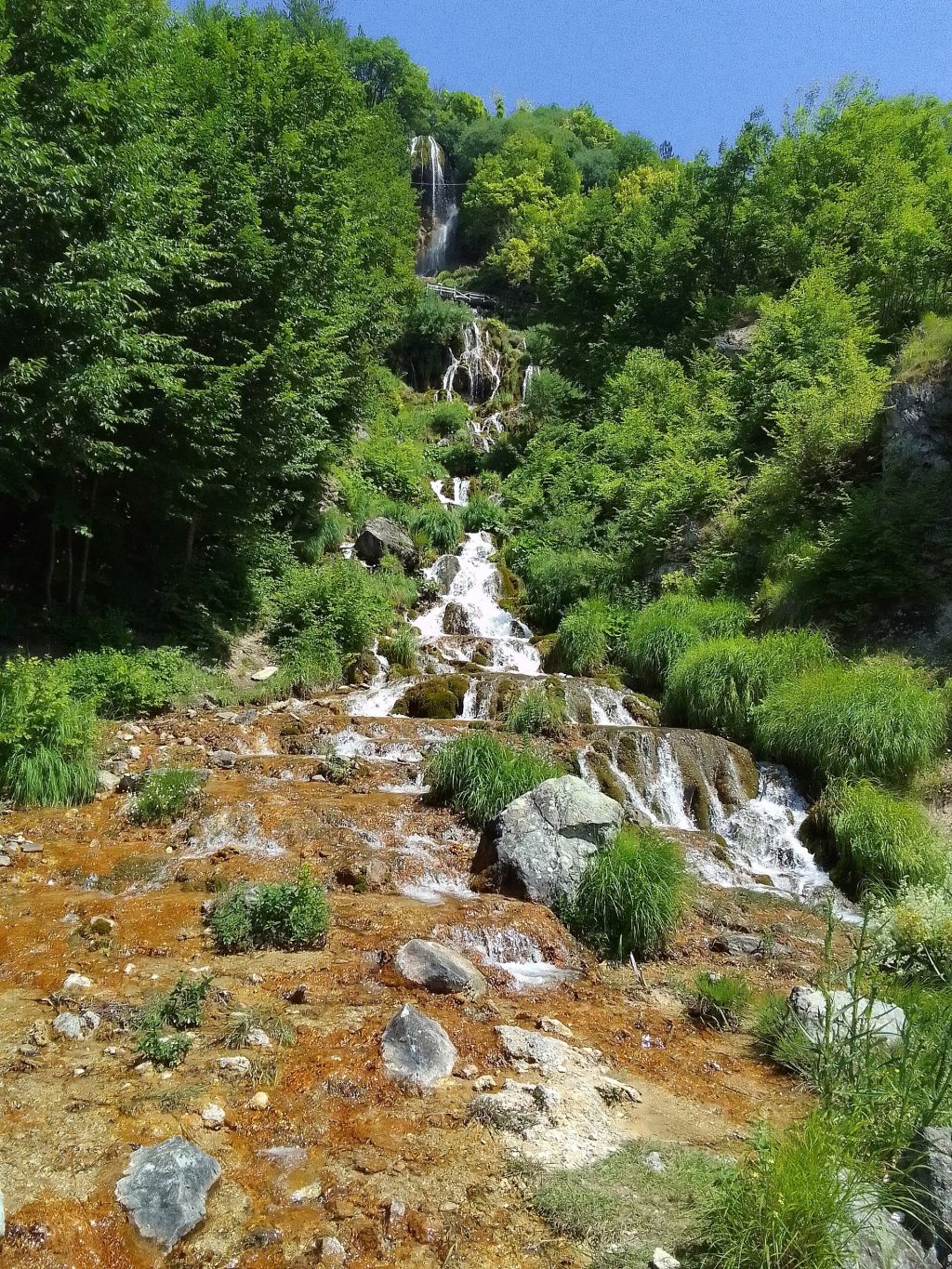
Sopotnica Waterfalls
The main natural focus above the settlement
A sequence of cascades on the Sopotnica River. The visit is generally self-guided, but no validated circuit length, difficulty grade, ascent or standard duration is published.
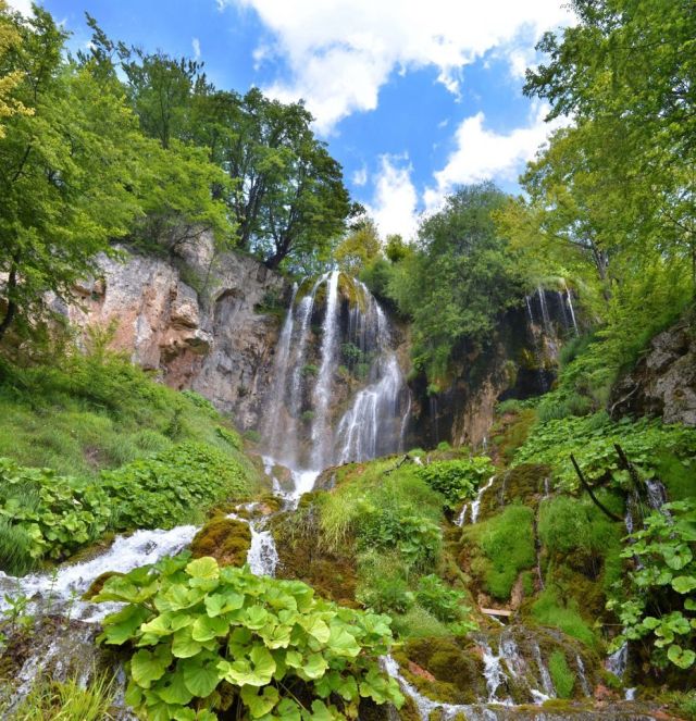
Sopotnica Wooden Watermills
Timber mill structures beside the watercourse
The old mills are part of the documented rural landscape. Public opening arrangements are not published, and visitors should not assume that every structure can be entered or is currently operating.
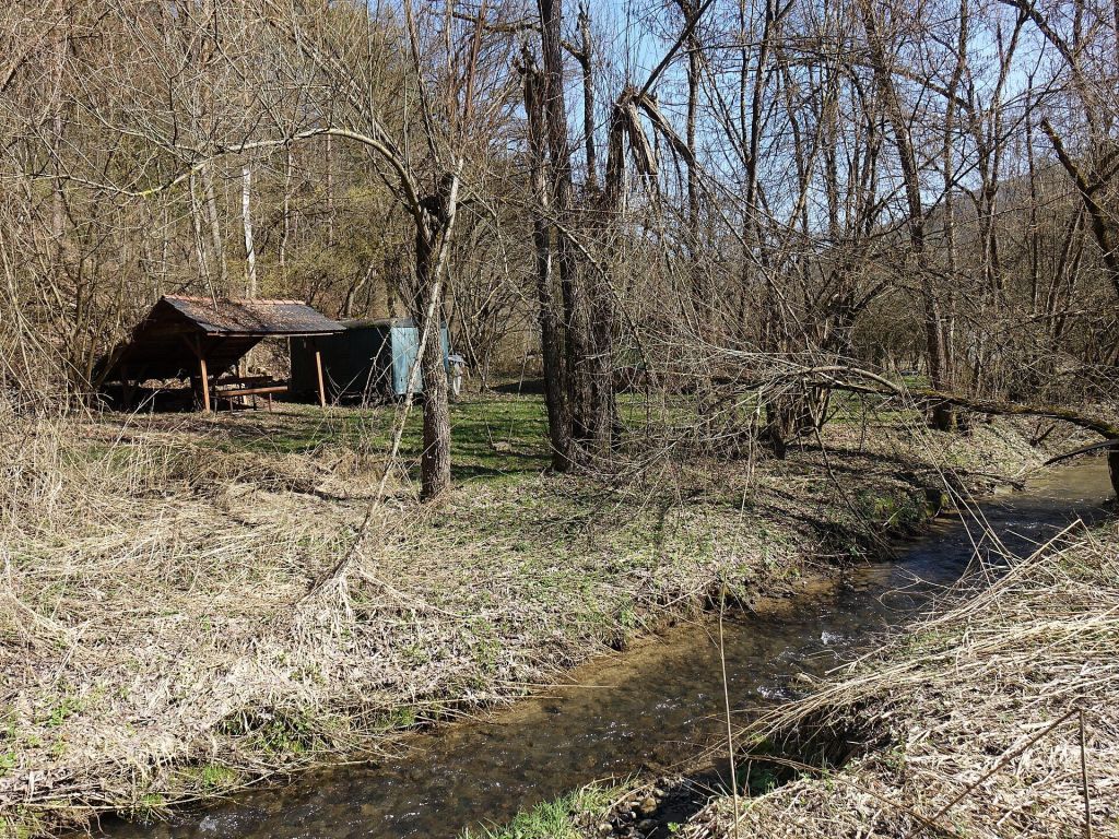
Sopotnica Village
The inhabited setting around the falls and mills
The village provides the spatial context for the water system, traditional hospitality and documented local food customs. It is a settlement rather than a ticketed attraction complex.
Jadovnik Mountain Hut near Sopotnica
A documented mountain facility with unconfirmed current services
A hut is identified near Sopotnica, but current staffing, beds, meals, opening hours, prices and reservation arrangements are not published. Its presence should not be treated as proof of available accommodation.
Sopotnica bb, 31305 Sopotnica, Serbia
Prijepolje, the regional gateway
Waterfalls and wooden watermills
Admission price not published
No official season; choose stable conditions and daylight
No requirement published for the falls; confirm hut and food separately
Slapovi Sopotnice is the Serbian name used for the Sopotnica waterfalls. Keeping that wording available can help when confirming the destination locally.
No universal difficulty grade or surface description is published. Use current local advice and the forecast to decide whether footwear intended for wet or uneven ground is necessary.
The presence of a mountain hut does not establish that camping is permitted beside it or elsewhere in the protected landscape. Obtain explicit local permission before planning any tent-based stay.
Do not rely on finding walk-in refreshments in the village. Bring sufficient supplies for the intended outing unless a host or service provider has confirmed a specific arrangement.
No current admission price is published. The absence of a published price should not be treated as confirmation that every activity, hosted visit or local service is free.
No validated route length, ascent or standard walking duration is published. Choose a turning point from current local advice and the available daylight.
A local bus line number and timetable to the waterfall area are not published. Travellers without a car should confirm local road transport and the return arrangement before departure.
Public interior hours and demonstration schedules are not published. View the mills without crossing private ground, and ask permission before approaching or entering any structure.
The hut is documented near Sopotnica, but current beds, staffing, prices and booking methods are not published. Confirm operation directly before relying on it for accommodation.
No current accessibility assessment or universal difficulty grade is available. Families and visitors with mobility needs should obtain recent local information before deciding whether the conditions are suitable.
Stay connected in Serbia