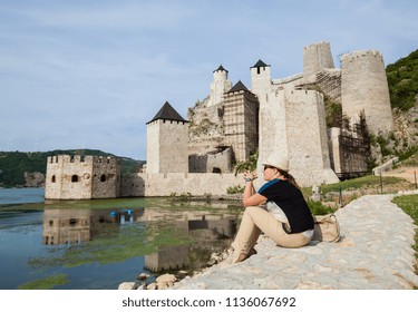
Karataš archaeological site near Kladovo; a full postal address is not published

Diana at Karataš occupies the Danube corridor at Karataš, about 8 km upstream from Kladovo. The complex was fortified in the late first century, when this stretch of river carried military and navigational importance during the Dacian campaigns. Its position belongs within the broader landscape covered by Kladovo's Danube and archaeology guide, but Diana is an individual Roman site rather than a name for the dam, Pontes or Trajan's Bridge. The experience is interpretive rather than monumental: the value lies in relating the surviving plan to movement, command and supply.
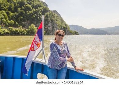
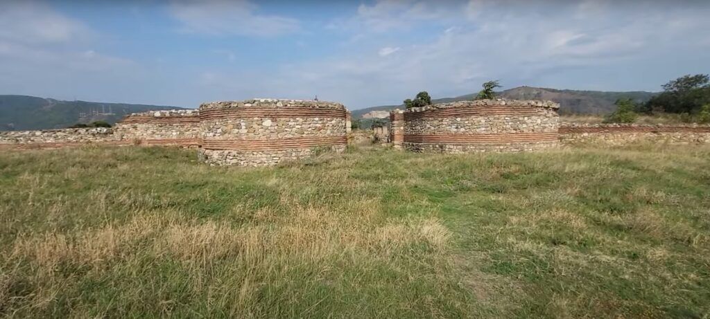
Begin with the enclosure rather than searching immediately for a single display object. A Roman gate channelled people, animals and supplies through a point that could be watched. Towers strengthened places where defenders needed a wider field of observation or a more secure position. Together, those elements turned the perimeter into a system for controlling movement.
The archaeological plan documents the defensive components, but it should not be mistaken for a guaranteed signed walking circuit. Current visibility, ground conditions and permitted routes through the remains have not been established. Use the plan to ask how a person or wagon would enter, where movement would narrow and how the garrison could respond from the perimeter, without assuming that every wall line is readily identifiable on the ground.
Beyond the military enclosure, remains attributed to a smaller settlement, a shrine and a necropolis broaden the story. They indicate that Diana's landscape extended beyond soldiers and fortifications into worship, burial and civilian activity associated with the military presence.
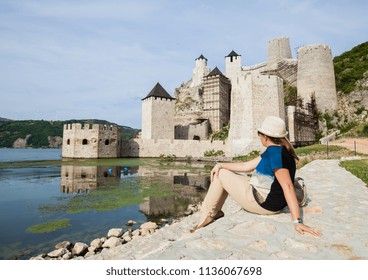
A frontier fort could not function on defensive architecture alone. Food had to remain usable, personnel needed working and living spaces, and command routines had to continue even when campaigning disrupted normal movement. Diana's granary gives that logistical layer a recognisable form. It represents planned storage rather than improvised provisioning and helps explain how the garrison could maintain operations along the river corridor.
The heated multi-nave building adds another dimension. Heating required construction, fuel and maintenance, all of which depended on labour and an organised supply chain. Its presence therefore matters even when the precise use of each internal space cannot be stated with confidence. The headquarters area, barracks and other facilities complete the pattern: administration directed the unit, accommodation housed personnel, and service buildings kept the institution operating.
This is the productive way to understand Castrum Diana. The fort was not only a wall facing an enemy. It was a managed community whose military reach depended on grain, fuel, repair work, record keeping and predictable access to the Danube corridor.
Several Roman and modern engineering sites cluster around Kladovo, which makes their names easy to merge. Diana is the fort at Karataš. Pontes was a separate Roman installation associated with the southern bridgehead of Trajan's Bridge. The bridge itself crossed the Danube and belonged to a larger imperial programme of movement and campaigning. Treating all three names as one place obscures the different work each structure performed.
The nearby hydroelectric dam belongs to a much later transformation of the river. It changed the modern landscape, but it is not part of Diana's Roman plan. A useful itinerary can connect these subjects while keeping their chronology and functions distinct: Diana for garrison defence and supply, Pontes and the bridge for the river crossing, and the dam for twentieth-century engineering.
The Roman Tabula Traiana is another separate monument. It is a rock-cut inscription connected with Trajan's Danube works, not a gate, tower or building within Diana. These distinctions make the Kladovo corridor easier to understand without reducing it to a single Roman-emperor route.

Diana is described at Karataš, about 8 km upstream from Kladovo, on or near the Belgrade–Kladovo road beside the Danube. That regional description is useful for orientation, but it is not a verified final approach, parking instruction or safe pedestrian route. A georoute that mentions walking should not be read as proof that every modern roadside section is suitable for pedestrians.
Confirm the exact entrance or meeting point before leaving Kladovo. No current online reservation page or published guided-visit duration has been identified. Travellers can call the Tourist Organisation of Kladovo or email the Kladovo tourist office to ask whether entry is available, where a driver should stop and whether a local guide can be arranged. Serbia's national tourism information for Diana provides historical context, but it does not replace direct confirmation of current arrangements.

No verified day-by-day schedule, seasonal opening period or staffed visiting window is published for Diana. Choose a date only after confirming that access is available rather than building a fixed itinerary around an assumed opening time.
If a visit is permitted, daylight is the practical choice for interpreting low masonry and the relationship between the perimeter and internal buildings. That is viewing advice, not an opening-hours statement. No dependable basis currently exists for recommending a particular weekday or season. Ask whether advance notice is required and whether changing ground or road conditions affect the agreed approach.

Diana is an archaeological reading exercise rather than a reconstructed fortress experience. The useful questions concern relationships: where the enclosure controlled movement, how command buildings occupied the interior, and why storage and heating mattered to a frontier garrison. Some remains may require a plan or explanation to distinguish one function from another.
No current dress code, staffed reception, toilet provision, shelter, interpretive service or step-free route has been established. Accessibility for wheelchair users, people with limited mobility and families using pushchairs must therefore be confirmed before travel. The same caution applies to bringing children, since the permitted route and relationship to the modern road are not documented as a managed visitor circuit.
A guided visit is not currently published as a standard product, and no duration is available. If local tourism staff confirm access, ask whether interpretation can cover the rampart, headquarters, granary, heated building and remains outside the fort. That produces a coherent visit without assuming unrestricted movement through the archaeological area.
Use these unresolved points as a call list before setting out from Kladovo.
Confirm directly before travel. These entries record the limits of currently published visitor information and do not establish that access is available.
Archaeological interpretation and visitor-planning statements were checked on 17 November 2026. Current entry arrangements should be reconfirmed directly before travel.
The map search shows Diana's regional position near Kladovo. Confirm the current entrance, stopping point and permitted approach locally before relying on the displayed pin for final navigation.
These four documented elements show how defence, command, heating and storage worked together. Current admission, hours and visitor circulation have not been published for any part of the complex.
Rampart, four entrances and towers
The perimeter controlled passage into the fort and strengthened vulnerable points along the enclosure.
Read the entrances as managed thresholds rather than simple gaps in a wall. Their relationship with the towers helps explain how the garrison observed and regulated movement.
Principia with portico
The headquarters area represents administration and command inside the military complex.
The principia separates the fort's command function from its defensive edge. A documented portico helps identify it as an organised architectural focus rather than an ordinary accommodation block.
Heated multi-nave building
A substantial heated building points to organised daily use within the Roman compound.
The documented heating and multi-nave form are significant, but the available interpretation does not justify assigning an unsupported modern visitor label or a precise use to every room.
Granary and supply area
The granary makes food storage and logistical preparation visible in the plan of Diana.
Stored provisions reduced the fort's dependence on immediate deliveries and helped sustain military activity along the Danube corridor. It is the clearest structure for reading supply at the site.
Karataš archaeological site near Kladovo; a full postal address is not published
Kladovo, about 8 km from the site
Roman defence, Danube navigation and military supply
Late-first-century fortification associated with the Dacian-war context
Not published
Not published
Confirm access before choosing a day or time
Not published
Tourist Organisation of Kladovo
Start at the perimeter and ask how entry was controlled. Move conceptually to command and accommodation inside the fort, then to heating and storage. Finish with the settlement, shrine and burial area beyond the military enclosure. This order separates defence from the systems that sustained it.
English-language references may use Diana at Karataš, Diana Karataš, Diana Karatas, Diana Karatash or Castrum Diana. Serbian Cyrillic forms include Диана Караташ and Дијана Караташ. These spellings refer to the same Karataš fort near Kladovo, not to Pontes.
A documented building plan does not guarantee that every wall is exposed, labelled or included in a permitted visitor route. It also does not establish a modern entrance, parking place or safe roadside walk. Keep archaeological interpretation separate from current access planning.
The Archaeological Museum of Đerdap appears in regional georoute material, but a same-day museum visit is not guaranteed. Its current opening status should be checked separately rather than treated as part of an automatically available Diana visit.
A current public entrance arrangement has not been published. Confirm availability and the exact meeting or stopping point with the Tourist Organisation of Kladovo before travelling.
No dependable current admission price or free-entry policy is published. Ask about any fee when confirming access.
No. Diana is the Roman fort at Karataš, while Pontes was a separate installation associated with the southern bridgehead of Trajan's Bridge.
The documented complex includes a rampart, entrances, towers, military buildings, a principia with portico, a heated multi-nave building and a granary. A settlement, shrine and necropolis are identified outside the fort.
No standard guided programme, duration or online booking page has been published. Ask the Kladovo tourist office whether local interpretation can be arranged for the intended date.
A step-free route and current ground conditions have not been documented. Confirm the permitted route and roadside approach before planning a visit with mobility requirements.
Stay connected in Serbia