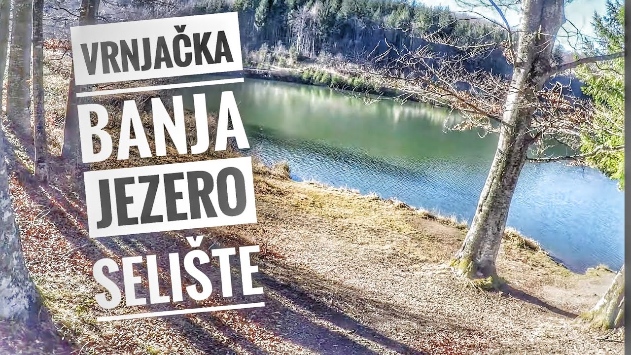
Jezero Selište Mala
Selected routeThe compact reservoir circuit covered here.
- Route form
- Circular walk around Lake Selište
- Figures
- Published in the route table above
- Visitor decision
- Use this exact name when confirming the start

This guide covers Jezero Selište Mala, the specifically named Selište small circular walk. It does not describe every Goč hiking route, the separately listed larger lake circuit, or the circuit connecting the centre of Goč with the reservoir. Use the route-figure table for the selected walk and treat the other names as distinct choices. No verified GPX file, precise trailhead pin or turn-by-turn sequence is available, so the guide explains scope and preparation rather than attempting navigation.
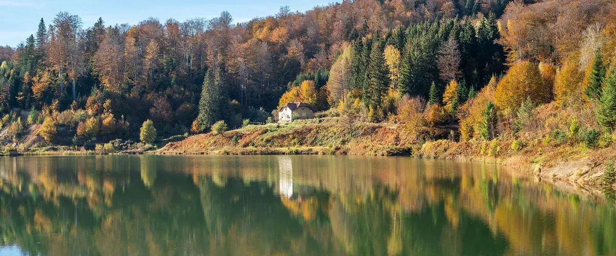
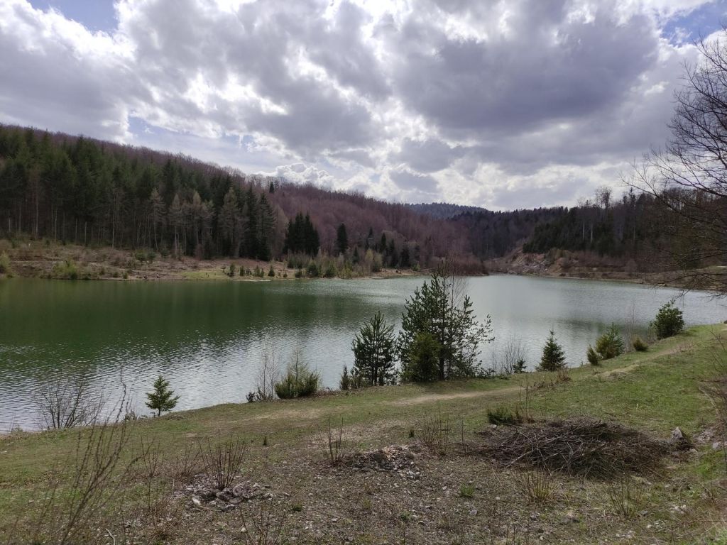
Lake Selište lies at Gvozdac on Goč Mountain, within the visitor landscape associated with Vrnjačka Banja. It is an artificial reservoir created for the spa town’s water supply rather than a recreational swimming lake. The selected path stays focused on the reservoir and its surrounding marked walking network, giving the outing a compact shape instead of the feel of a longer mountain traverse. The experience is defined by changing views toward the water, with practical limits imposed by the reservoir’s working purpose.
Gvozdac is the location to keep in mind when distinguishing Lake Selište from walks beginning elsewhere on Goč. Vrnjačka Banja is the practical visitor base named with the lake, but the selected route does not begin in the spa-town centre. Build the mountain excursion around the broader orientation in the Vrnjačka Banja spa and park guide, then obtain a current starting point before travelling uphill.
The reservoir’s role matters to the visit. It supplies water to Vrnjačka Banja, so the shore is not presented as an open bathing or angling destination. Marked walking paths are identified around the lake, but that description does not establish the present state of every marker. Arrive expecting a walking landscape with protected water, not a serviced lakeside recreation complex.
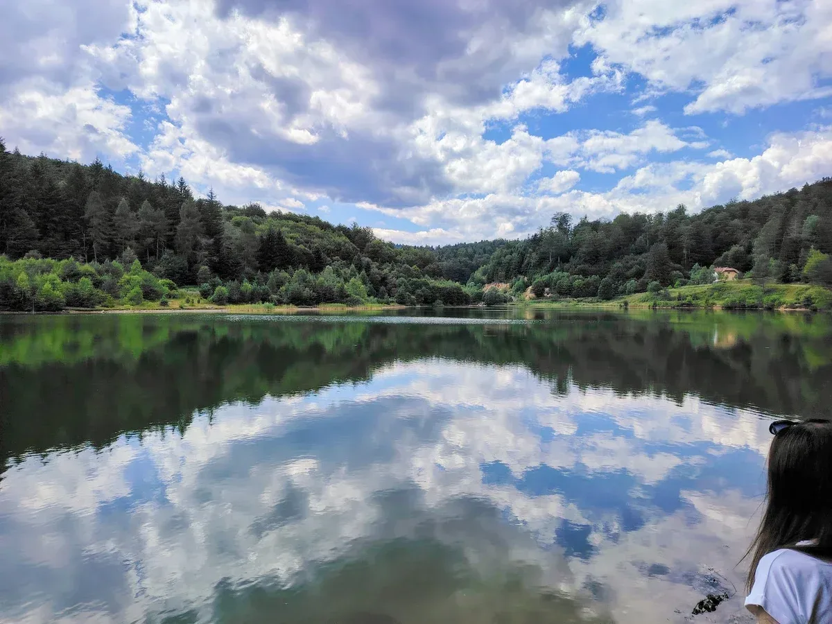
The Selište small circular walk is described as a circuit for seeing and photographing the reservoir from different sides. That lake-view purpose is the route’s defining quality: walkers move around one compact body of water instead of using it merely as a waypoint on a broader Goč itinerary. The circular format also makes it easier to understand why the walk has its own name rather than being treated as a segment of another trail.
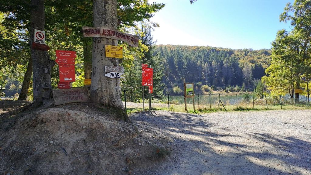
Do not turn that broad description into invented directions. The available visitor information does not establish a precise first junction, direction of travel or sequence of landmarks. Marked paths are identified, yet no current inspection of signs or maintenance is promised. At the start, match the local route name to Jezero Selište Mala before committing to a path. If a sign points to a larger Selište route or a Goč-centre circuit, pause and confirm which option it represents.
Swimming and fishing are prohibited at Lake Selište. The rule follows the reservoir’s function in Vrnjačka Banja’s water-supply system, so the water should be treated as protected infrastructure rather than an amenity attached to the walk. A warm day, an accessible-looking bank or the presence of picnic activity does not change those restrictions.
Keep the outing land-based. Photography and walking are the relevant activities described for the route; entering the water, angling or presenting the reservoir as a beach would misrepresent the site. Picnic wording also does not establish permission to camp, light fires or remain overnight. Anyone considering an activity beyond an ordinary walk should obtain direct local confirmation instead of inferring permission from the landscape.
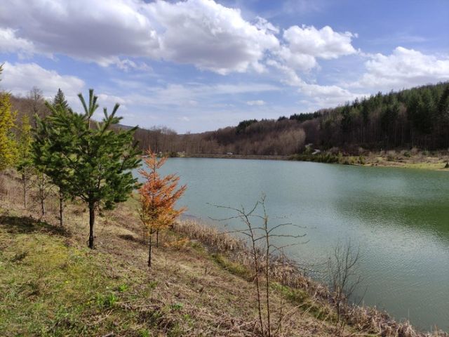
Use Lake Selište at Gvozdac as the destination area, then confirm the exact Jezero Selište Mala starting point before departure. A postal trailhead address, walking time from the nearest fixed landmark and dependable final approach are not published. The route should not be presented as beginning in Vrnjačka Banja’s centre, and Kraljevo is not the trail start.
No verified numbered bus line, timetable or stop serving the precise start is available. A typical taxi fare is also not published, and there is no confirmed parking provision that can be promised. If approaching through the wider region, the Kraljevo travel guide can help with regional orientation, while getting around Serbia explains the broader differences between buses, trains, taxis and rental cars. Neither replaces a local check for the final Goč approach.
Before paying for a taxi or committing to a drive, ask for Lake Selište at Gvozdac and specify Jezero Selište Mala. Confirm where the driver can safely leave and collect passengers, whether the last road section is currently usable and where the small-loop signs begin.
The route is presented for family walks and recreational visitors, but that description is not an accessibility certificate or a current safety assessment. The available details do not define the surface throughout the circuit, path width, gradients at particular points, barriers or step-free alternatives. Stroller and wheelchair suitability therefore remain unconfirmed.
Mountain conditions can change the practical character of even a short route. No all-season assurance is published for winter, snow, ice, prolonged rain or periods of trail work. Check the forecast and current local condition, then choose footwear for an outdoor path rather than relying on the route’s modest recreational classification. Families should make an independent decision based on the youngest walker, current ground conditions and the ability to turn back safely.
Bring personal drinking water because the presence of a reservoir or nearby streams does not establish that untreated water is drinkable. The same caution applies to facilities: toilets, shelters, food outlets and waste collection at the precise walking start are not confirmed.
No official season, daily schedule or opening hours are published for the small loop. Plan for enough daylight to locate the correct start, complete the circuit without rushing and return to the agreed transport point. A weekday may simplify an independent outing, but no dependable crowd pattern is documented.
Seasonal decisions should follow current mountain conditions rather than a fixed calendar recommendation. Reconsider the walk when snow, ice, poor visibility, strong weather or recent heavy rain could affect an unverified surface. If local guidance cannot confirm conditions, select another activity rather than treating the short published duration as proof that the route is safe in every season.
Expect an independent outdoor walk whose attention stays on the reservoir. There is no published admission procedure, guided departure, equipment service or reservation system for the circuit. Free entry has been reported, but that does not imply staffed access or visitor facilities.
Dress for a mountain path and carry what is needed for a self-contained short outing: water, weather protection, a charged phone and an offline record of any locally confirmed directions. Noise guidance is not formally stated, though a restrained approach is appropriate around a protected water supply and other walkers. Children need ordinary supervision near the shore, and dogs or other special access needs should be checked locally because no detailed policy is available.
The most important expectation is uncertainty at the approach rather than difficulty inferred from the route figures. Once the exact circuit is identified, keep to the confirmed path, observe all reservoir restrictions and avoid switching inadvertently to one of the longer named alternatives.
Sources cross-checked for this guide:
Last checked: 15 October 2026. Fact-checked by the editorial team led by Nenad against the official sources above, and reviewed before publishing.
These figures belong only to Jezero Selište Mala. They should not be transferred to either of the separately named route variants.
The estimate does not include time spent locating the correct start, checking signs or stopping for photographs.
The route names describe different outings. Choose by exact name rather than combining fragments of their descriptions.
The compact reservoir circuit covered here.
A longer route around the Selište area.
A route connecting the Goč centre area with the lake.
No verified GPX track or turn-by-turn navigation is available for these options.
Route scope, measurements, reservoir purpose and restrictions were checked on 9 October 2026. Conditions and access can change, so confirm them before travelling.
The map identifies the general Lake Selište area at Gvozdac on Goč. It should not be treated as a verified small-loop trailhead or turn-by-turn route.
These four names help separate the chosen circuit, the reservoir location and the two longer alternatives. Published opening hours are unavailable, and free admission has been reported for access to the lake area.
Jezero Selište Mala
The selected short circular walk around the reservoir.
Use this exact route name when asking locally for the correct starting access and signs.
Lake Selište at Gvozdac
The artificial reservoir around which the selected route runs.
This is a water-supply reservoir with walking paths, not a swimming or fishing lake.
Larger Selište Lake Loop
A separately listed lake route that should not be confused with the small circuit.
Its measurements are distinct and must not be reconstructed from the small-loop figures.
Goč Centre–Selište Lake Circuit
A separate circuit connecting the centre of Goč and Lake Selište.
It is not a town-centre walk from Vrnjačka Banja and is outside the scope of the small loop.
No postal address published; Lake Selište, Gvozdac, Goč
Lake Selište reservoir
Short circular reservoir walk
Free admission reported
Daylight after current conditions and access are confirmed
No reservation requirement published
Keep out of the water and do not fish. Lake Selište serves Vrnjačka Banja’s water supply, and no exception for recreational visitors is published. Carry away anything brought to the shore and avoid treating reservoir access as permission for other waterside activities.
A current public-transport connection to the route start is not established, so no bus line number should be inserted into an itinerary. Parking location, capacity and road condition are likewise unpublished. Confirm the complete approach locally rather than assuming that a general lake map pin identifies a usable trailhead.
“Suitable for family walks” describes the intended recreational character, not guaranteed conditions. Ask about current surfaces and obstacles if travelling with a stroller, a wheelchair user, a child who needs close supervision or anyone with limited mobility.
Opening hours for the route and a dedicated online reservation channel are not published. For current access information, contact the Vrnjačka Banja tourism information centre, the Vrnjačka Banja tourism office or send the tourism office an email. Ask specifically about Jezero Selište Mala, present signs, the final road and the safest place to begin.
No. The named walk is around Lake Selište at Gvozdac on Goč. Vrnjačka Banja is the associated visitor base, but the exact mountain starting access must be confirmed separately.
No. Both swimming and fishing are prohibited because Selište is a water-supply reservoir.
No verified GPX file is supplied for the route. Obtain current local directions and match signs to the exact route name before walking.
Step-free access, path width and surface continuity are not certified. Family-oriented wording should not be treated as confirmation of stroller or wheelchair suitability.
A confirmed parking location and current capacity are not published. Ask where a vehicle can stop legally and safely before driving to Gvozdac.
No. Free admission has been reported, but opening hours, staffed access, visitor facilities and a reservation procedure are not published.
Stay connected in Serbia